Datamine Discover 3D

3D Modeling for Mineral Exploration

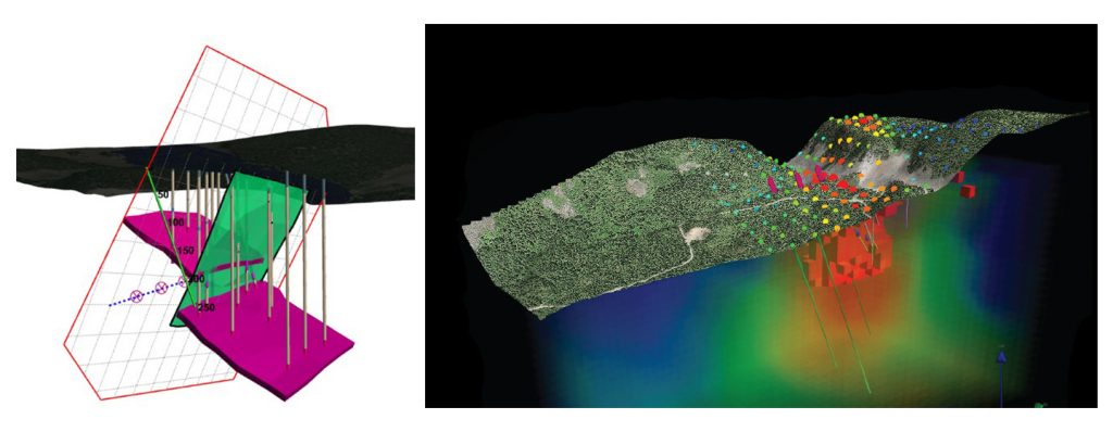
Learn how 3D modeling can help you make better-informed decisions in all stages of the mineral exploration process. From grassroots to advanced drilling projects, 3D modelling is rapidly replacing traditional 2D sections and plan views as the modern tool for exploration planning. 3D modeling allows users to simultaneously display surface and subsurface data, communicate exploration ideas, and can be used for investor presentations. This two-day (four half-days online) Discover 3D course focuses on exploration planning, targeting, and data presentation using integrated drilling, geophysical, geochemical, and imagery data. The Discover 3D course is an advanced level course and attendees must have prior experience with (and a good working knowledge of) 2D Datamine Discover. It is strongly recommended that attendees take the Datamine Discover Modules 1 and 2 courses prior to attending this 3D course. Each attendee requires their own computer and a Datamine Discover 3D 2019 license. Free evaluation licenses can be provided, but these must be requested and installed before coming to class.
View Sample Course Notes

Datamine-Discover3D

Course Outline

  • Exploring the Discover 3D interface
  • 3D Navigation: flying, rotating, panning, and zooming
  • 3D Cursor Plane
  • Orthographic view – A crucial tool and concept in visualizing spatial relationships in 3D
  • Discussion: 3D geomatics and spatial data accuracy issues. Re-projecting 3D files. The consequences of using multiple elevation datums – an issue that cannot be ignored
  • Clipping for sectional and down-plunge viewing
  • Saving 3D session (project) files
  • Preparing 2D data for 3D display
  • Viewing draped surface imagery
  • 3D point and line data. Incorporating soil data into the 3D model
  • Vector data display (DXF files, mine workings, geological solids)
  • Gridded data display (DEM files, geochem, and geophysics)
  • Block (Voxel) model display and querying. Display slices and grade shells
  • Drillhole Display. Query lithology and set threshold grade values
  • Exporting 3D slices to 2D sections
  • 3D digitizing and object editing. Points, lines, polygons, polyhedral faces, and solids with volumes
  • Geological Modeling – solid generation and fault surface creation
  • Determining dip / dip direction, plunge, true thickness, and projected sub-surface feature locations
  • Modeling the intersection of geological features (for example, structure and stratigraphy) for determining plunge orientation
  • Drillhole planning
  • 3D videos and animations: Communicating ideas effectively for intuitive presentations

Upcoming Dates:

August 28, 2020 – Vancouver

Register