GraphMap
Introduction to Graphical Analysis Using Datamine Discover
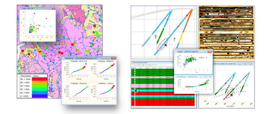
Put your geochemistry data to work using simple empirical procedures. This two half-day online course includes a series of hands-on, case study-based exercises designed to introduce geologists to Discover’s GraphMap module and the basics of graphical analysis. GraphMap is included with all Discover licenses. Practical examples involve surface geochemistry, drillhole geochemistry, and drillhole survey data. The course may prove particularly useful to geologists wishing to use down-hole geochemistry data for geological modeling, as an aid to re-logging core, and for the re-coding of lithologies in existing drillhole databases.
Graphs provide visual summaries of quantitative data that quickly reveal information such as trends and relationships that are not apparent when viewing tables of numbers, maps, or drillhole displays relying on subjective data such as rock codes. Rather than relying on the interpretation of the numerical results of statistical calculations, graphical analysis relies on spatial pattern recognition and the linking of graph selections, colours, and symbols with 2D and 3D spatial plots. Combined with the 2D and 3D data display capabilities of Discover and Discover 3D, GraphMap can be an extremely powerful tool to develop and test hypotheses involving geochemistry data.
The course does not teach geochemistry or statistics. Though geochemistry and statistical concepts are discussed throughout the course, attendees require a working knowledge of geochemistry and a working knowledge of simple statistical concepts such as mean, median, standard deviation, percentiles, population, and dispersion. A good working knowledge of Windows and Datamine Discover is mandatory.
Each attendee requires their own laptop computer and a copy of Datamine Discover 2017. Free evaluation licenses can be provided to those without the required software. Evaluation licenses must be requested in advance and installed before the course date.
Recommended Prerequisites:
Mapinfo with Datamine Discover – Mineral Exploration Module 1
Mapinfo with Datamine Discover – Mineral Exploration Module 2
