You are here:

Discover what advanced technology, operated by our experienced personnel, can accomplish for your project.

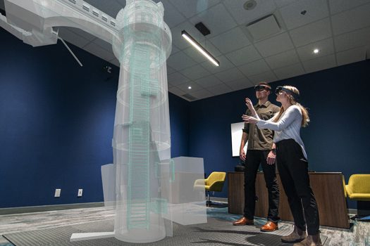
We use state of the art drones, LiDAR, and other equipment to be the eyes in the sky, on the ground, and below the water’s surface. We use the latest data tools to analyze, visualize, and apply our understanding. We use spatial tools, 3D models, and virtual/augmented reality to share our insights.

The Right Tools.

Our experienced Geospatial team own and operate the latest Airborne LiDAR systems available on the market – the Leica Terrain Mapper2 and the Teledyne Galaxy T2000.

These state-of-the-art 2MHz laser systems are equipped with medium format 4 bands cameras – which means they provide significantly higher point densities than other commonly used models. This also allows them to provide increased accuracy at greater flying heights, allowing high collection efficiencies even in complex and changing terrain. What does that mean for you? These new sensors help us plan our flights and collect data more efficiently – which means we can scan more projects and capture more data in any environment -giving flexibility to work within tight timelines and budgets.

Leica Terrain Mapper2

The Leica Terrain Mapper2 is the latest linear-mode LiDAR airborne sensor, providing the highest performance for regional mapping projects. The sensor system delivers outstanding accuracy, unmatched point density, and even point distribution, from flatlands to mountainous terrain. It integrates the most innovative optical system on the market, delivering high quality images with every flight – even in difficult lighting and weather conditions.

Leica Terrain Mapper2

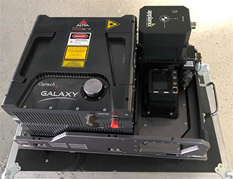
Teledyne Galaxy T2000

The Teledyne Galaxy T2000’s is the next evolution in the Galaxy platform, allowing for improved sensor mount flexibility while boasting an impressive technical setup for maximum collection efficiency and point density. The T200’s benefit comes from it’s ability to maintain fixed-width data swaths in mountainous terrain via an innovative and dynamic field-of-view, allowing for fewer flights and more even data points compared to other sensor. It also specializes in improved ground detection in heavily forested environments, allowing us to map terrain more accurately in dense environments.

Harnessing this new technology, with staff equipped to effectively work with the collected data, we can offer modular and scalable airborne mapping solutions for your complex LiDAR projects.

T2000

The Right People.

Behind every piece of innovative technology is a knowledgeable professional equipped to use it. Our Geospatial team know how to operate and optimize these machines for the best data collection, while possessing the technical skills to process and interpret the data to produce clear, meaningful direction for your project.

Together, we combined 40+ years of experience in high-definition survey, remote sensing, point cloud modeling, and project management, having worked with clients across the Energy & Resources sector, to government bodies, and even educational institutions.

STEVE_ROMBOUGH_Cropped

Steve Rombough, Branch Manager – Vancouver Geospatial

Managing McElhanney’s Vancouver Geospatial branch, Steve brings over 20 years of experience in surveying and engineering- specializing in remote sensing and high-definition survey methods. Steve works with all things LiDAR, conducting airborne operations for LiDAR and orthophoto acquisition, terrestrial mapping using mobile LiDAR and static laser scanning, and coordinating our corporate Remotely Piloted Aircraft Systems program (drone / UAV).

From a technical perspective, no one does data like Steve. He specializes in the processing and management of big data for large scale infrastructure projects that incorporate topographic, legal, engineering, and construction surveys. He also manages McElhanney’s Advanced Research and Technology division.

AZADEH_KOOHZARE_Cropped

Azadeh Koohzare, Ph.D, P.Eng, CMS, Division Manager

Having managed more than 150 geospatial projects over her 20+ year career, Azadeh’s expertise in geospatial projects and LiDAR / airphoto survey is hard to match. As a division manager with McElhanney Ltd., she is a performance-driven leader who successfully manages cross-functional teams. Azadeh excels in fostering an environment for collaboration, resulting in successful completion of challenging projects and a high level of client satisfaction.

Her work includes multi-year LiDAR and airphoto survey across thousands of square kilometers for areas and corridors across BC, Alberta and Yukon. Outside Canada, Dr. Koohzare is recognised for her work in South America, Africa, Middle East, and Southeast Asia. In addition to her tangible project successes, Azadeh’s innovative solutions developed for the industry has been presented and published in more than 20 peered reviewed journals and conferences.

Azadeh obtained her Ph.D. in Geomatics Engineering from the University of New Brunswick. She is an industry advisor for several national, government and academic committees.

The Right Projects.

From pipelines and mineral exploration to municipal infrastructure and private projects – our Geospatial team are always busy working on a wide range of projects. Thanks to our dedicated staff, ability to quickly put boots to the ground, and the advanced technology we deploy we provide quick and reliable turnaround times.

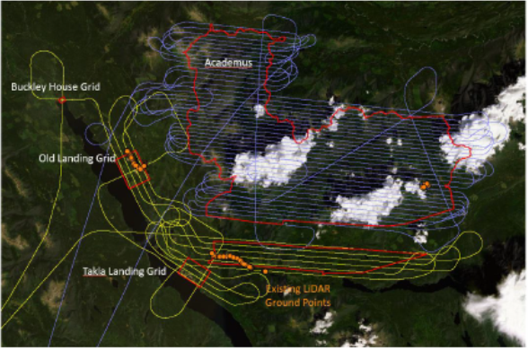
Skeena and Stuart Nechako Project – LiDAR and Orthophoto Data Capture and Processing

Client: GeoBC | 2020-21
Skeekna and Stuart Nechako Projec

Services Provided:

McElhanney was able to utilize the Galaxy system to gather data in difficult mountainous terrain with extensive river valleys, accurately mapping 2894.68 Km2 at 11 different sites across BC.

TC Mainline – LiDAR to Support Right-of-Way Management Program

Client: TC Mainline | 2020-21
TC Mainline

Services Provided:

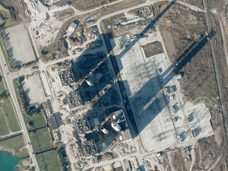
McElhanney conducted an airborne and ground survey campaign to support the right-of-way management program for the TC Mainline. The majority of the 4,800km2 corridor was collected in under 2 months, allowing TC to proceed confidently on schedule, backed by a massive amount of data.

2021 Dempster Highway-Ogilive and Wisley Airports

Client: Government of the Yukon | 2013-ongoing

Services Provided:

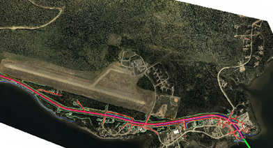
Utilizing the Leica Terrain Mapper2, McElhanney successfully acquired LiDAR and aerial photography along Dempster Highway, as well as Ogilive and Wisley Airports in rural Yukon. This data allowed for the production and delivery of the final elevation models for the dense corridor.

Innovation at work.

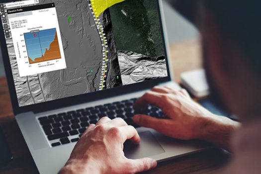
McElhanney has developed Vertisee, an in-house web-based platform that integrates the power of Geographic Information Systems (GIS) with easy-to-use maps. It allows our clients to access project-by-project site data from any internet browser, at any time.

Vertisee can accommodate any type of data that can be placed on a map, including roads, pipes, building, vegetation, cadastral lot plans, environmental features, events, and more. Vertisee data can be accessed in real-team and easily shared with your staff, clients, partners, or the public. It’s an easy solution to stay up-to-date with the projects you care about. Visit our Vertisee page to learn more.

Artificial Intelligence

Staying at the cutting edge of new technology, McElhanney has been testing Artificial Intelligence (AI)-based technology, also known as deep learning, to create 3D city models from LiDAR datasets. Employing AI-based methods in industry-level projects requires a well-constructed workflow with robust datasets. As models get trained up, AI and its offshoot, machine learning, will be a foundational tool for future engineering and business success.

VertiseeFeaturedImage-1024x492
3D Visualization Demo

Tell us about your project, and we’ll tell you how we can help. Get in touch.

Delivering LiDAR solutions across the globe.

LiDAR is just one service we provide. From engineering to surveying to planning, check out our other services here.