MapInfo with Datamine Discover
Mineral Exploration Module 1
This course covers introductory to intermediate GIS and MapInfo Discover topics. The goal of this two-day course is to familiarize students with the various functions of Datamine Discover, MapInfo, and the fundamental geomatics / GIS concepts that all GIS users should understand. Students will complete a regional-scale GIS compilation project with real mineral exploration data. Project planning issues and common pitfalls are discussed throughout the course. Exercise books and course data are provided by McElhanney. The course is taught using Datamine Discover (formerly MapInfo Discover), version 2019. Each attendee requires their own computer and a copy of Datamine Discover 2019. Free evaluation licenses can be provided, but these must be requested and installed before coming to class. Students must be familiar and comfortable with the basic functions of MS Windows. Previous MapInfo Discover experience is not required. Publicly available, real mineral exploration data is used for all exercises.
Why is the Module 1 course important for people who have already used MapInfo-Discover before?
Many people who have used MapInfo Discover for a while (or were self-taught / taught by a coworker), make the assumption that taking the introductory course is unnecessary. Why is the Module 1 course important? Learning to use GIS and 3D modeling software involves far more than learning which buttons to click to make products you want. A prerequisite to using any GIS, drillhole, or modeling software is an understanding of several important geomatics and spatial data concepts. These concepts are taught to surveying students and formally trained GIS professionals, but they are rarely taught to geologists or exploration technicians. A list of common and potentially expensive errors includes: plotting / modeling samples, geophysical data, drillholes in incorrect locations; planning drillholes based on incorrectly located targets; and storing the wrong kind of azimuth or elevation values in drillhole tables (a potentially serious but common error). Do you know the difference between UTM north and true north where you are drilling? Have multiple elevation datums been used in surveys over the years? In addition to many time saving procedures and tools users may not have seen before, the concepts you need to know to identify and / or avoid these errors are introduced in the Module 1 course.
Course Outline:
- Learning the basics of tables, workspaces, and the Discover interface
- Discussion: Project folder and file organization. Avoiding problems with workspace files. Tools for fixing workspaces
- Map Window Layers: Using the layer control to make selections, link map windows, manipulate layers, labels, and feature display settings
- Discussion: Geomatics concepts crucial for GIS users: Coordinate system issues, consequences of projection and datum errors, and avoiding costly mistakes
- Graphical Selection: Different methods of graphically selecting, displaying, and saving selections from a map window
- Creating New Tables and Basic Digitizing Skills: Table design issues, data storage, planning a digitizing session, and basic drawing tool skills
- Data Entry Techniques: Tools for increasing efficiency in data entry and data validation. Updating tables with formulae and expressions
- Discussion: Map scales, positional error, and digitizing accuracy. Choosing appropriate base-map and elevation data for your own projects
- Using Imagery: Using satellite images, scanned maps, orthophotos, and other imagery. Image rectification and reprojection
- Importing and using geotagged photos
- Importing and Exporting Vector Data: Working with GPS data, CAD files, shapefiles, etc.)
- Point Data: Designing MS Excel spreadsheets for use in database programs Displaying sample locations and other coordinate data stored in MS Excel spreadsheets and Access database files
- Queries: Searching data, creating database-generated map layers, separating data for analysis
- Discussions: Grouping – Compiling data while building in the ability to analyze it separately later. This is GIS, not CAD – understand the difference
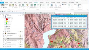
- Thematic Maps: Creating database-generated symbology. Effectively display geochemistry and other data. Communicating effectively through maps
- Map Design and Plotting: Scaled Map Output and the Layout Window, elements of proper map design, map legends. Creating layered and geospatial PDF files