You are here:

Get to Know McElhanney’s Mining & Mineral Exploration Services

Get the support you need.

Whether you are in the exploration, operation, or closing phase of your project, our mining & mineral exploration professionals offer the support you need. No job is too small or too onerous for our local teams; we are ready to dig into your mining and mineral exploration challenges!

TalonGillis_07092_Web
Rich History.

Since 1910, McElhanney has contributed to the success of projects at all stages of exploration and mining; something few companies can claim. For example, our VP Geomatics was a young surveyor at Eskay Creek during the early stages of advanced exploration. To this day, McElhanney is still supporting the project, with survey and LiDAR services.

Insider Perspectives.

Our expertise is enhanced by several team members who spent 25+ years working for major mining companies and for junior explorers. This has gained McElhanney the reputation of being a trusted advisor; we help you get the most out of the data we provide while offering insider perspectives.

Global Expertise.

McElhanney has a rich history of providing surveying and mapping projects to companies world-wide, on time and on budget. Our understanding of the logistics required to deliver projects of this scale makes us a leader in providing surveying and mapping services to the mining industry.

Trust Our Senior Mining
& Mineral Exploration Professionals

Engineering

We know your mining projects require specialized engineering. Our engineering expertise for the resource sector is extensive and we are ready to help you with various specialized components for your next project. We also offer civil, geotechnical, and hydrological engineering to provide comprehensive service to any mining-related project including access roads, bridges, and camp and water needs. Our Engineering page offers a full list of services.

Greg Poznikoff_Cropped

Greg Poznikoff, PEng – Branch Manager
Kamloops Engineering

Get In Touch

“I know first-hand the value that local boots on the ground bring to mining projects. Let’s chat about how my team can help with your next project.”

T: 250-434-9525
E: gpoznikoff@mcelhanney.com

Surveying

As one of McElhanney’s core service offerings since 1910, surveying is in our blood. We know what it takes to survey your remote mine site. Our team of professional surveyors and technicians has provided geomatics support to the mining sector within Canada, and internationally. From mineral tenure review and government consultation, to engineering surveying support, we have a proven track record providing experienced personnel to meet all your project requirements. Visit our Geomatics page for a full list of services.

VANCOUVER, BC_MARCH 16_2015: Individual head shots of employees as McElhanney hosts a company marketing workshop for executives across the Western Provinces. (Photo by Kim Stallknecht)

Jim Christie, BCLS, CLS – Vice President
Vancouver Region Geomatics & Geospatial

Get In Touch

“Our team’s years of experience helping our clients build their projects from exploration to operation will help you find value-added solutions to your survey needs. Please contact me to find out how we can help with your projects.”

T:604-424-4747
E: jchristie@mcelhanney.com

Mapping

Your mapping projects need the best technology to ensure accuracy. In addition to traditional and GPS-based surveying methods, we have a fleet of unmanned aerial vehicles (drones), terrestrial laser scanning units, and LiDAR / air-photo collection systems to meet all of your topographic mapping, terrain modelling, and underground scanning needs. Our GIS services allow for efficient data and asset management while our geospatial and geological data services provide drillhole and geochemistry data services, maps, cross-sections, imagery, and 3D-modeling for any stage of mining and exploration. Visit our GIS and Remote Sensing page to learn more.

Andrew McIntosh, GISP – Project Manager
GIS, LiDAR Mapping, Geological Data Services

Get In Touch

“I love that McElhanney can add value for clients beyond being a data or service provider. Whether it’s training and supporting geologists in GIS and 3D modelling, or talking to them about how to use LiDAR data, the best part of my job is being involved in our client’s projects as a trusted advisor.”

T: 604-683-8521
E: amcintosh@mcelhanney.com

Environmental Services

Involving an integrated environmental team early in your project provides you with better cost control, improved project design, and reduced regulatory risk. Our environmental team, comprising of professional biologists and environmental engineers, understand the requirements of regulatory agencies and provides a range of services including environmental assessments and monitoring, as well as complex wildlife studies. To discover more about these services, please visit our Environmental Services page.

Brad Pollard_Cropped

Brad Pollard, MSFM, R.P.Bio., R.P.F., Environmental Expert
Environmental Services

Get In Touch

“I’ve worked extensively with organizations, government agencies, and First Nations to resolve development-related habitat identification and protection issues. Are you ready to discuss your next project?”

T: 250-631-4097
E: bpollard@mcelhanney.com

Take confidence in our Industry-Certified Standards

Quality Commitment

Our quality management system has been certified to ISO 9001:2015 standards for the provision of engineering, surveying, mapping, planning, and environmental services. We are also certified to Engineering & Geoscientists British Columbia Organizational Quality Management (OQM) standards. McElhanney has in place an Energy Safety Canada COR (BC, AB & SK) certified HSE Management System (HSEMS) and an internal responsibility system.

Indigenous Partners

We have a long history of partnership and respect with First Nations groups in Western Canada. We consistently seek to find meaningful ways to partner with indigenous and local communities, businesses, and individuals to promote economic development and sustainability.

Safety Imperative: Work safe. Home safe.

The safety of your crews and team members is McElhanney’s top priority. We are committed to a proactive and systematic approach to health, safety, and the environment.

Demonstrated Experience

red chris mine day 2 001_Cropped

Tatogga Lake, BC

Red Chris Mine

Client: Imperial Metals | Services Provided: Surveying

Benefit to the Client

Imperial Metals needed a survey consultant with experience through all stages of a project whom they could trust. McElhanney’s team of professional surveyors offered the knowledge in legal and engineering surveys to be able to respond to all of Imperial’s requests. Our team completed all assignments on time and on budget, and met all last minute requests.

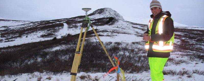
Between 2004 and 2012, McElhanney was contracted by Imperial Metals to carry out a series of surveys from drill collar and topographical surveys to mining lease (mineral tenure), first order control, and high precision layout surveys to aid in the exploration and construction of the Red Chris copper / gold mine in Northwest BC. During construction, McElhanney provided up to four crews year-round to the project.

DSCF1573

New Aiyansh, BC

Avanti Kitsault Mine Project

Client: Avanti Kitsault Mine Ltd. | Services Provided: Traffic Impact Survey & Environmental Assessment / Management Plan

Benefit to the Client

Facing a variety of scopes, Avanti Kitsault Mine Ltd. needed a multi-disciplinary consultant whom they could trust to complete a diverse set of projects. McElhanney leveraged our professional experience from multiple disciplines to offer our services on several projects, eliminating the need for Avanti to hire multiple consultants. Our team was nimble and when last minute requests came from Avanti, we were on-site the next day – ready to deliver and help keep projects on schedule.

Since 2012, McElhanney has completed several engineering projects for Avanti Kitsault Mine Ltd. (Avanti). From 2012 – 2018, our multi-disciplinary teams have taken on every project challenge as their own.

For example, in 2012, Avanti hired McElhanney to complete a traffic impact study for the proposed Kitsault Molydemum Mine Project. McElhanney completed a corridor assessment of both Highway 16 and Nass Highway; traffic counts with help from local Nisga’a residents; and identified potential hazards along proposed haul routes. In conjunction with the mine re-opening, our team also prepared an environmental management plan (EMP) for road upgrades associated with a Special Use Permit application.

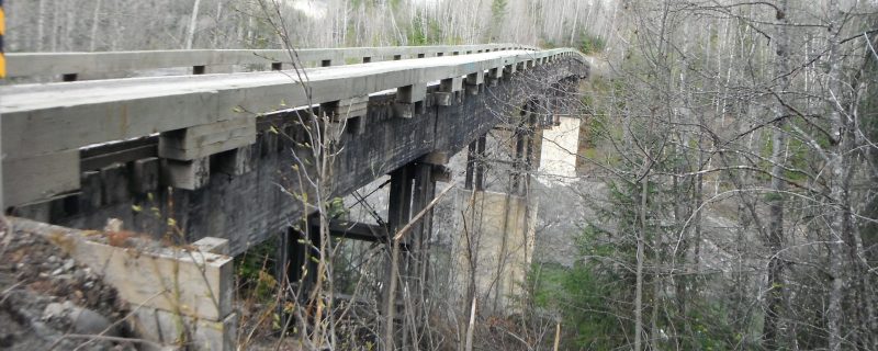
In 2014, McElhanney was also retained by Avanti to prepare an EMP in support of federal regulatory applications, provincial standards, and the Nisga’a Lisims Government for the replacement of the Nass River bridge structure on the Kinskuch Forest Service Road. The load rating of the existing bridge structure had been downgraded and was not rated to hold the anticipated loads associated with construction and development of the Kitsault Mine Project. McElhanney’s EMP addressed the environmental values of the sites, construction considerations, and best practices to implement during the replacement of the superstructure of the bridge.
Galore 2019

Northwestern BC

Galore Creek Mapping & LiDAR

Galore Creek Mining Corp. | Services Provided: LiDAR, Air Photo, and Supporting Ground Survey

Benefit to the Client

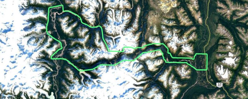
The Galore Creek’s northern project location posed significant weather-related challenges for aerial mapping. To successfully complete the acquisition, McElhanney took a firm commitment to safety, communications, data quality, and flexibility. Our approach to aerial mapping and surveying allowed mine and related infrastructure design work to proceed as planned.

In August, 2019 McElhanney was contracted by Galore Creek Mining Corp. to carry out a LiDAR and aerial photo survey covering approximately 1350 km² of mountainous terrain in northwestern BC. McElhanney was responsible for all aspects of the project including LiDAR and aerial photo survey design and acquisition; LiDAR, orthophoto and GIS deliverables; supporting ground survey work required to ensure data accuracy; project communications and safety. Acquisition was completed from late August to mid-September. Galore Creek Mining Corp. is using the LiDAR data and orthophoto for environmental studies, access road design, mine, and related infrastructure design work.

Contact Your Local Branch Today

The right tools. The right people. Since 1910.

With 30+ offices in Western Canada, our teams are ready to get to work on your next project.
Contact information for your local branch can be found on our Locations page.