You are here:

Renewable Energy Services

As demand for reliable, sustainable energy continues to grow, renewable energy projects require coordinated expertise to move efficiently from concept through construction and operation. McElhanney brings together experienced professionals in engineering, geomatics, geospatial, environmental, planning, and project delivery to support renewable energy developments across Western Canada. 

Our multidisciplinary teams work alongside developers, utilities, Indigenous communities, contractors, and other project partners to help identify opportunities, navigate site and regulatory constraints, reduce project risk, and support informed decision-making. From early-stage feasibility and site assessment through permitting, design, construction, and operations, we provide practical, locally informed solutions for wind, solar, hydroelectric, battery energy storage, and other renewable energy projects. 

Connect with one of our renewable energy experts to discuss how McElhanney can support your next project.

Peter Lund, Alberta Land Surveyor, P.Eng

Division Manager and Electrification Market Sector Lead – Calgary, Alberta 

plund@mcelhanney.com 

Dean Fischer, ALS, CLS, P.Surv.

Renewable Energy Lead – Calgary, Alberta

dfischer@mcelhanney.com

Thomas Dunkley Thomas Dunkley, BCLS, CLS, B.Tech. 

Sr. Division Manager – Kamploops, British Columbia

tdunkley@mcelhanney.com

McElhanney has supported renewable energy developments across Western Canada, providing multidisciplinary services throughout the project lifecycle. 

Planning & Site Development

  • Project planning and site analysis
  • GIS and spatial analysis
  • Site suitability and constraint mapping
  • Aerial LiDAR, photogrammetry, and remote sensing
  • Preliminary environmental assessments
  • Land, legal, and cadastral surveys
  • Stakeholder and Indigenous engagement support
  • Transportation and blade delivery route planning and permitting
  • Preliminary access, bridge, and crane-path assessments

Investigations & Permitting

  • Topographic and engineering surveys
  • Geotechnical investigations and recommendations
  • Environmental baseline studies
  • Wetland, wildlife, vegetation, aquatic, and fisheries assessments
  • Regulatory survey plans and permitting support
  • Water resources and hydrotechnical assessments
  • Drainage, stormwater, and flood risk analysis
  • Utility and interconnection corridor surveys

Detailed Design

  • Civil engineering and site grading
  • Access road and external government road design
  • Storm Management Design
  • Highway and municipal road intersection upgrades
  • Bridge and culvert assessments
  • Crane-pad and laydown-area design
  • Electrical Engineering
  • Structural engineering
  • Transportation and traffic engineering
  • Erosion and sediment control
  • Construction plans, alignment sheets, and digital models

Construction

  • Construction surveying and layout
  • Pile and equipment layout
  • Road, crane path, and pad layout
  • Quality assurance and field inspection
  • Materials testing
  • Environmental construction monitoring
  • Progress mapping and quantity verification
  • UAV imagery and construction documentation
  • Survey control and data management

Commissioning, Operations & Asset Management

  • Legal and as-built surveys
  • Record drawings and asset inventories
  • GIS and digital data management
  • Asset management
  • Aerial LiDAR and condition monitoring
  • Vegetation management
  • Environmental compliance monitoring
  • Drainage and erosion monitoring
  • Site expansion and optimization support
  • Decommissioning and reclamation planning

Wind

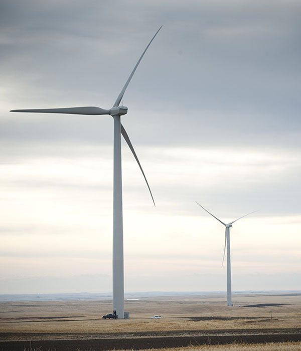
Wind Turbines in a field

McElhanney brings extensive experience supporting wind energy developments of varying scales. Selected examples of our project experience include Paint Earth, Whitla, Sharp Hills, Lanfine, Forty Mile, Hand Hills, and Windrise, collectively representing more than 300 turbines and 1,356 MW of generating capacity. These projects range from 29 to 68 turbines and from 145 MW to 300 MW, demonstrating our experience supporting wind developments of varying size and complexity.

Solar

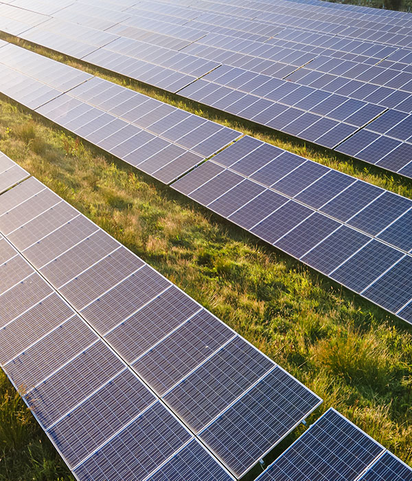
Solar Panel

McElhanney brings experience supporting solar energy developments of varying scales across Western Canada. Examples of our project experience include Brooks, Drumheller, Hays, Jenner, Claresholm, and Kneehill, representing a combined 223 MW of generating capacity. These selected projects range from 5 MW to 130 MW and highlight our ability to support both smaller installations and large utility-scale developments.

Featured Projects

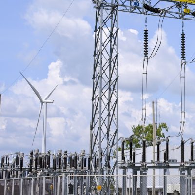
Electrical substation wind turbine power line blue sky green grass

Lanfine 150 MW Wind Project and Substation 

Client: Borea Construction ULC
Location: Oyen, Alberta
Years: 2021–2022
Services Provided: Civil Design, Geomatics, GIS, Legal Survey, Construction Survey, Wetland Survey and Reclamation Survey 

Project Summary 

McElhanney was contracted to provide comprehensive survey services and civil design for the Lanfine 150 MW Wind Project and associated substation near Oyen, Alberta. The team completed topographic surveys using drone and GNSS RTK methods to support project planning, permitting, civil design, and construction. 

McElhanney advanced the civil design from the 30% stage through Issued for Construction. The design scope included turbine sites, crane pads, crane-path slope analysis, access roads, county-road upgrades for blade delivery, and the substation drainage plan. An ESRI GIS system was also used to map proposed structures and make their locations readily accessible to field users.  

Construction-phase services included field layout for foundations, civil grading, access roads, collector lines, crane paths, county-road intersection improvements, and substation civil and structural works. McElhanney also prepared legal plans and Right-of-Way Plans for Alberta Land Titles registration, conducted wetland boundary surveys, and performed reclamation surveys alongside environmental consultants.  

Benefit to the Client 

By combining local knowledge, civil design, GIS, legal surveying, and construction surveying within one coordinated team, McElhanney provided consistent project information from planning and permitting through construction and reclamation. The integrated scope supported efficient field implementation, blade-delivery access, land registration, environmental coordination, and construction of the wind farm and substation. 

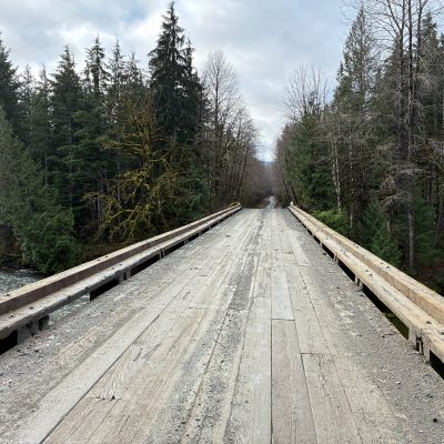
IMG_0009

Yəyus Energy Project Bridge Inspection & Load Evaluation 

Client: Borea Construction ULC
Location: Sayward, British Columbia
Services Provided: Bridge Inspection, Structural Evaluation, Geometric Review, GIS Asset Management, Ownership Plans, Crossing Plans

Project Summary 

McElhanney was retained by Borea Construction ULC to inspect and evaluate 29 resource and logging-style bridges along anticipated construction haul routes for the Yəyus Energy Project near Sayward, British Columbia. The structures ranged from single-span crossings between 10 and 40 metres long to multi-span bridges exceeding 80 metres and included log-stringer, steel-girder, and glulam-girder construction.  

McElhanney completed detailed, hands-on inspections using BC Ministry of Forests standards and documented each bridge’s geometry, condition, and recommended actions. Structural evaluations assessed the bridges against six axle configurations supplied by the client. The work included reviewing available drawings, comparing bridges with sealed drawings against their design vehicles, completing code-based structural evaluations where sealed records were unavailable, and reviewing clear widths and barrier heights against the proposed permit vehicles.  

Benefit to the Client 

McElhanney completed the inspection and evaluation program within the required schedule despite 12 additional structures being identified during fieldwork. The resulting report summarized the inspection and load-evaluation findings and provided recommendations for repair, rehabilitation, or replacement. Tablet-based inspection forms improved data collection and record management, while integration with McElhanney’s Vertisee GIS asset-management database improved the accessibility and long-term usability of the inspection information.

Screenshot 2026-10-14 153915

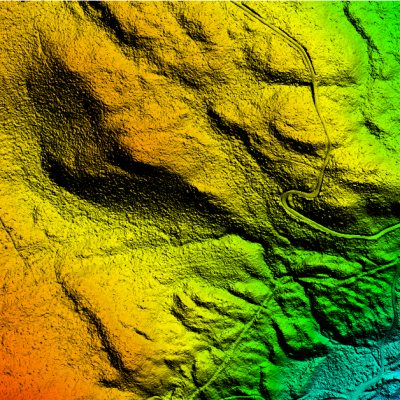
Wind Energy LiDAR & Orthophoto Program

Client: Capstone Infrastructure Corp.

Location: Multiple locations throughout British Columbia

Services Provided: Aerial LiDAR, Orthophotography, Flight Planning, Ground Survey,
Terrain Modelling

Project Summary

From May 2024 to September 2025, Capstone Infrastructure Corp. awarded
McElhanney 12 LiDAR projects for sites across British Columbia. Most assignments
supported proposed wind-energy projects associated with BC Hydro’s first and second
Call to Power phases, while three projects completed in 2025 supported construction
activities.

McElhanney provided LiDAR and orthophoto flight planning, snowmelt monitoring,
supporting ground surveys, and delivery of classified LiDAR data, digital terrain models,
and contours. Weather and snow conditions were monitored to identify the earliest
practical opportunities for aerial data acquisition following snowmelt.

Benefit to the Client
Depending on project size and client requirements, the assignments were completed
and delivered within four to six weeks of aerial acquisition. The coordinated collection of
survey, LiDAR, orthophoto, terrain, and contour information provided Capstone with
geospatial data to support wind-site design and construction activities across multiple
locations.

Our Locations

The right tools. The right people. Since 1910. With 35+ offices in Western Canada, our teams are ready to get to work on your next project.