
Our Services
Airborne LiDAR
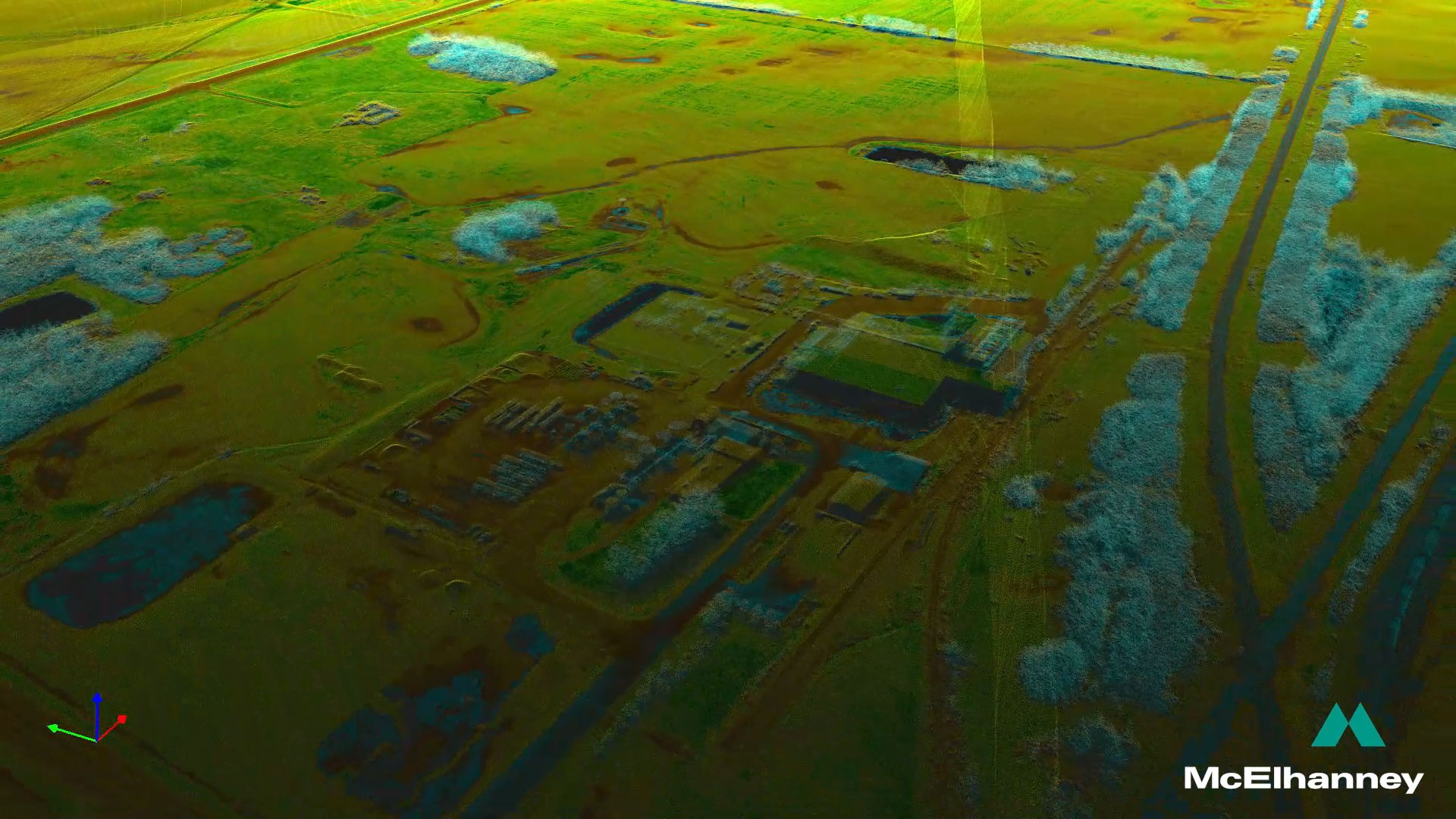
Airborne LiDAR delivers high-resolution, large-area spatial data from aircraft to support planning, design, and analysis across landscapes. We help clients gain accurate elevation, terrain, and feature datasets that inform critical decisions for infrastructure, environmental impact assessments, and resource management.
- Highly flexible airborne operations across Canada and internationally
- High-density terrain and vegetation modeling
- Topographic, corridor, and corridor change detection analysis
- Integration with aerial imagery for enhanced mapping
- Digital elevation models (DEMs), point clouds, and orthophotos
- Applications in city planning, flood and hazard analysis, and forestry inventory
Drone-based LiDAR
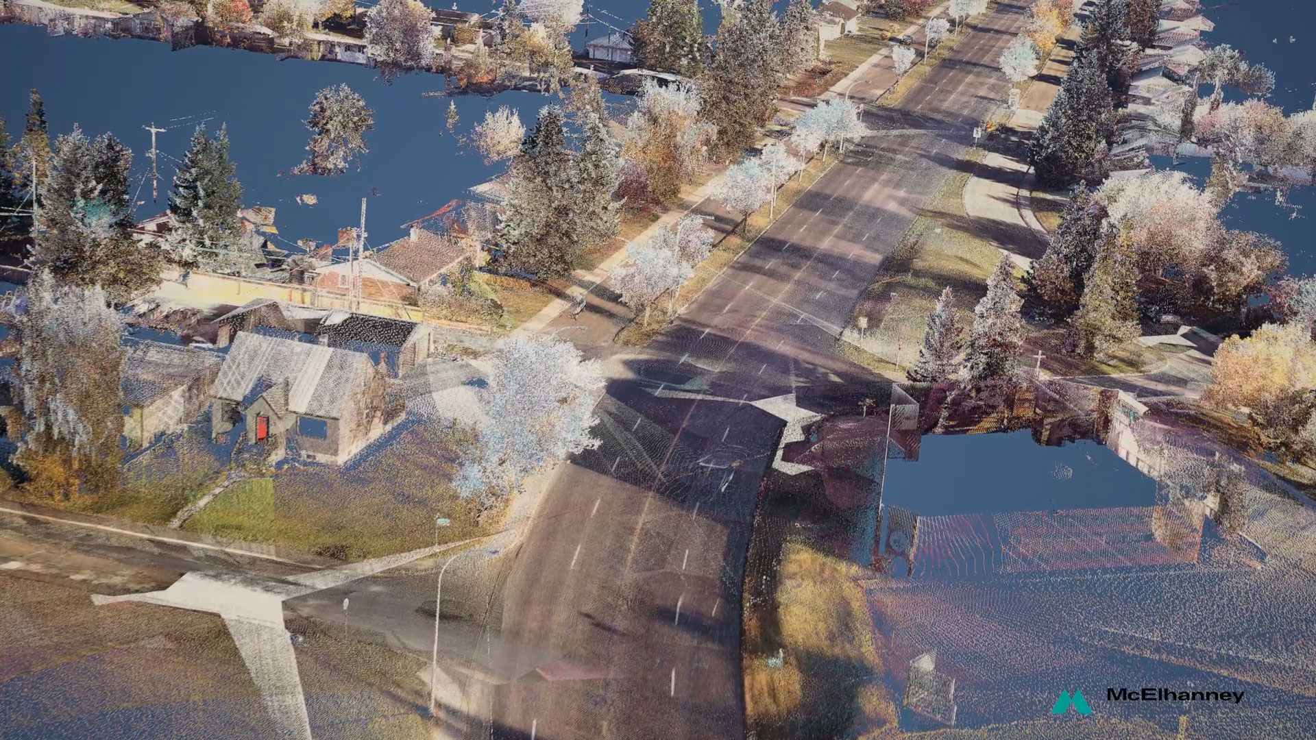
Drone LiDAR combines the mobility and precision of Remotely Piloted Aircraft Systems (RPAS) with advanced laser scanning technology to capture highly detailed spatial data. It is particularly effective in complex environments and remote or hard-to-access locations where traditional surveying methods are impractical or unsafe.
- RPAS-based LiDAR and imagery deployment for targeted site capture
- High-resolution terrain and surface modeling in confined or rugged terrain
- Volumetric measurements and change detection for construction or mining
- Vegetation and forest stand analysis at the site level
- Asset condition monitoring and infrastructure inspection
- Integration with photogrammetry and multispectral imaging workflows
- 80 registered drones across our program
Terrestrial LiDAR
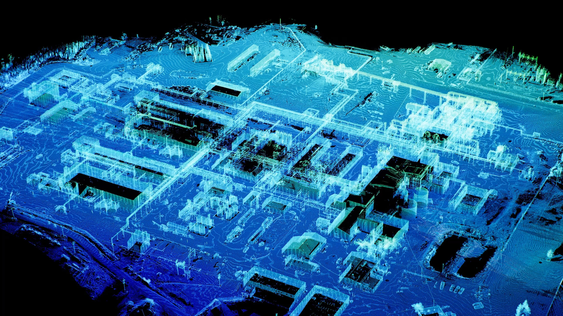
Terrestrial LiDAR provides ultra-detailed, ground-based three-dimensional scanning of structures, environments, and site features. This close-range laser scanning is optimized for capturing fine geometric detail — making it invaluable for as-built documentation, engineering surveys, and complex site assessments.
- Static and mobile ground LiDAR scanning for high-precision 3D capture
- As-built documentation for buildings, bridges, and infrastructure
- Topographic and corridor surveys with fine surface detail
- Point cloud processing and extraction of engineering deliverables
- Integration with BIM and CAD for design and analysis
- Site monitoring and deformation analysis over time
Where Technology Meets Experience

A Multi-Disciplinary, Integrated Approach
Our clients benefit from McElhanney’s fully integrated, in-house, multi-disciplinary team. This one-stop approach streamlines communication, shortens project timelines, and reduces risk. By seamlessly integrating LiDAR data with engineering and design needs, we deliver clear, actionable insights that support confident decision-making and better project outcomes.

Change Detection
Airborne and drone-based LiDAR enable precise change detection by capturing high-resolution spatial data over time. This allows clients to clearly identify topographic and structural changes, even in areas obscured by dense vegetation. By comparing “as-built” conditions with repeat surveys, LiDAR supports accurate surface and volumetric analysis — pinpointing where material has been added, removed, or shifted. The result is reliable insight into erosion, settlement, and other site changes that supports proactive decision-making and effective asset management.

Machine Learning Workflows
With nearly two decades of airborne LiDAR and imagery collection, McElhanney maintains a growing archive of high quality datasets that support validation, benchmarking, and change detection—adding confidence and consistency to new projects. This archive also strengthens our in-house machine learning, providing training data to refine proprietary classification and analytics models for higher accuracy, better feature extraction, and more efficient processing.
Our Work in Practice
CanXport Intermodal Facility
Prince Rupert, BC (March 2023 – Ongoing)
Client:
Prince Rupert Port Authority
Services Provided:
RPAS (drone) survey support, volume tracking, conventional survey and progress monitoring
The Challenge:
Servicing the CanXport (formerly RIELP) project in Prince Rupert required overcoming complex logistical and technical hurdles. These large-scale terminal developments demanded precise, repeatable volume tracking and progress monitoring to satisfy client reporting standards and regulatory requirements.
Our Solution:
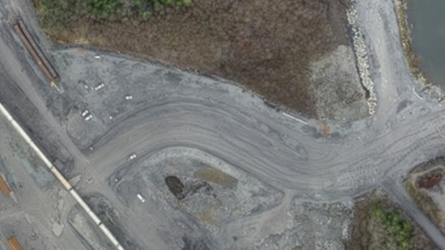
Daily drone missions captured high-resolution imagery and generated orthomosaics, Digital Terrain Models (DTMs), point clouds, and meshes for volumetric auditing. In addition, LiDAR data has been collected for the original ground surface and other localized surfaces throughout the project. Managing these workflows meant coordinating rapid data processing, ensuring accuracy across blended surfaces, and integrating outputs into client platforms. In addition, we were focused on maintaining operational efficiency and project compliance.
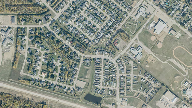
Capstone Infrastructure Wind Energy LiDAR and Orthophoto (2024 – 2025)
Client:
Capstone Infrastructure Corp.
Services Provided:
LiDAR and orthophoto flight planning, delivery of classified LiDAR data
The Challenge:
From May 2024 to September 2025, Capstone awarded McElhanney 12 LiDAR projects across multiple sites in BC—primarily to support wind energy site proposals under BC Hydro’s Call to Power (Phases 1 and 2), with three 2025 projects supporting construction. Each site required tight acquisition windows, including ongoing monitoring of weather and snow conditions to capture the earliest possible post-snowmelt data, while still meeting fast turnaround expectations for planning and regulatory schedules.
Our Solution:
We delivered end-to-end LiDAR and orthophoto flight planning and execution, coordinating acquisition timing around snowmelt through regular condition monitoring. Depending on site size and client requirements, we processed, classified, and delivered the LiDAR datasets on an accelerated schedule—typically within 4–6 weeks of flying—providing Capstone with reliable terrain and site data to advance proposal development and support construction-ready deliverables on the 2025 projects.
Meet Our Experts

Steve Rombough, DipIT
Branch Manager, Geospatial
Steve has over 23 years’ experience working in different roles across the architecture, engineering, and construction industry. He currently leads McElhanney’s digital group and manages the Geospatial Branch that specializes in remote sensing and high-definition survey methods. Additionally, Steve oversees McElhanney’s Advanced Research and Technology Division, mandated to investigate new technologies and emerging processes. From a technical perspective, Steve specializes in the processing, management, and integration of big data for large-scale multi-disciplined infrastructure projects.
 Our philosophy is simple: understand the client’s challenge, then bring the technology that delivers the clearest, most reliable solution.

Azadeh Koohzare, PhD, P.Eng., CMS
Division Manager, Airborne LiDAR
Dr. Azadeh Koohzare is the Division Manager for McElhanney’s Airborne Mapping division and brings more than 25 years of experience in geomatics and remote sensing across Canada and internationally. She leads an established airborne LiDAR group that has been part of McElhanney for over 20 years, building on more than 50 years of firm‑wide mapping expertise. With a strong combination of technical depth and management experience, Azadeh oversees the planning, execution, and quality assurance of large‑scale airborne LiDAR and geospatial projects, ensuring consistent, high‑quality delivery while supporting the continued evolution of the division’s technical capabilities and market applications.
We see our clients as partners. When they succeed, we succeed—and our role is to provide the best solutions to help them get there.

Mike Morellato, MSc
Division Manager, Drone LiDAR
Mike Morellato has 20 years of experience working in GIS, remote sensing, and RPAS. roles spanning various sectors, with a focus on environmental applications. In addition to project management, his technical interests include added-value LiDAR deliverables, AI tools in the drone space, and machine learning applications for imagery analysis. He leads an RPAS Division at McElhanney, part of our wider drone program comprised of 180 pilots and over 80 registered drones, one of the largest in Canada.
We respond quickly and communicate clearly, delivering accurate, actionable insights from drone data so you can make confident decisions and keep your projects on track.

Chris Gilling, AScT
Division Manager, Terrestrial LiDAR
Chris Gilling has 11 years’ experience managing McElhanney’s Vancouver laser scanning division, working in a project management and technical role with laser scanners, UAVs and other HDS data, as well as surveying using conventional and GNSS methods. He has managed and processed complex survey data for dozens of facilities, transportation, and infrastructure projects, working with multidisciplinary teams and using technology to optimize budgets.
Laser scanning and reality capture provide precise, data-driven insights that empower clients to optimize resources and reduce their environmental impact. By enabling informed decision-making, these technologies play a vital role in advancing climate-centric goals and fostering sustainable project outcomes.