Haisla Land Use Planning
2016 – 2020 | Kitimat, BC
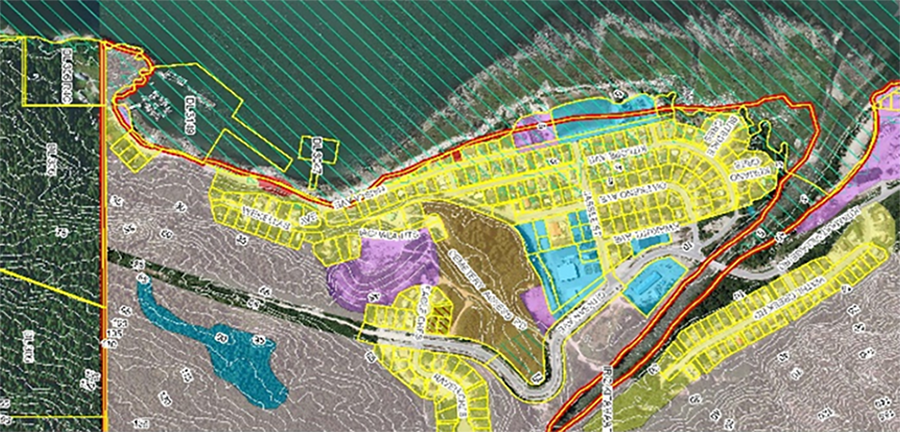
McElhanney helped develop a land use plan as part of the implementation of the First Nations Land Management Act for Haisla First Nation (HFN). The land use plan covered 18 reserves and used a multitude of data layers and forms of stakeholder engagement. Vertisee, McElhanney’s web-mapping application was used to help bring historic data together to form the new land use plan to aid in management, governance, and future growth of the reserves.
Information gathered through the engagement process was managed using McElhanney’s GIS system, Vertisee, to identify potential land use conflicts and synergies, and for client representations for staff and the community as the project progressed. GIS inputs included georeferenced photographs, legal parcel information, orthographic photos, proposed land uses, elevation, and conceptual climate change-related sea level rise.
Vertisee was an invaluable tool to be able to have all stakeholders be able to share and see the data without being on site
McElhanney provided:
- Overall coordination of land use planning and public / stakeholder engagement
- Detailed property-specific planning advice
- Input and management of Vertisee, our GIS system


