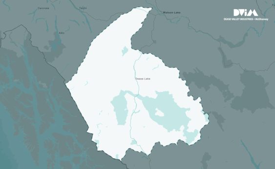
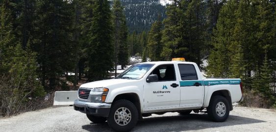
Skip to content
Search:

LOGIN

QUIZ

CONTACT

Linkedin page opens in new windowTwitter page opens in new windowFacebook page opens in new windowInstagram page opens in new window
McElhanney
McElhanneyMcElhanney
    • Home
    • About
    • Services
      • Geomatics
      • Engineering
      • GIS & Remote Sensing
      • Planning
      • Landscape Architecture
      • Environmental
    • Portfolio
    • Careers
      • Career Opportunities
      • Culture
      • Career Growth
      • Students & New Graduates
    • News
    • Locations
    Linkedin Twitter Facebook Instagram
ZoomDetails

Watson Island Redevelopment Project

Award-Winning Project, British Columbia, Cities & Communities, Construction Surveys, Drones & Robotics, Energy & Resources, Environmental, Environmental Assessment, Environmental Site Assessments & Remediation, Geotechnical, GIS & Remote Sensing, Legal and Engineering Surveys, Lower Mainland, Mapping, Market Sectors, Mitigation, Compensation, & Restoration, Northern, Interior, Central BC, Reclamation, Region, Regulatory Approvals & Agency Liaison, Structural, Sustainable Feature, Vancouver Island, VertiseeBy Andrea de VriesDecember 14, 2022

Because of the Watson Island Redevelopment Project, the Prince Rupert community has witnessed a new beginning for the site of a former pulp mill.

Highway Engineering Services - Asset Management
ZoomDetails

Highway Engineering Services – Asset Management

British Columbia, Engineering, GIS & Remote Sensing, GIS & Spatial Analysis, Mapping, Parks, VertiseeBy Felicia KurnadiSeptember 8, 2021

McElhanney’s in house web mapping platform, Vertisee, was used to host all of the relevant project information including current and historical assets, orthophoto, LiDAR and field crew assessments.

Highway 1 – 264 to Whatcom Rd. Field Coordination
ZoomDetails

Highway 1 – 264 to Whatcom Rd. Field Coordination

British Columbia, GIS & Remote Sensing, GIS & Spatial Analysis, Lower Mainland, Mapping, VertiseeBy Felicia KurnadiSeptember 8, 2021

McElhanney deployed Vertisee, its own web-based mapping solution, and developed a tool within it which allowed multiple consultant / subcontractors to submit work simultaneously during the Highway 1 road upgrades.

Haisla Land Use Planning Featured Images
ZoomDetails

Haisla Land Use Planning

British Columbia, GIS & Remote Sensing, GIS & Spatial Analysis, Land Use & Approvals, Mapping, Stakeholder Engagement & Communications, VertiseeBy Felicia KurnadiSeptember 8, 2021

McElhanney’s GIS system, Vertisee, was used to identify potential land use conflicts and synergies, for a land use plan as part of the implementation of the First Nations Land Management Act for Haisla First Nation.

Metro Vancouver Regional Park
ZoomDetails

Metro Vancouver Regional Parks

3D Laser Scanning, British Columbia, GIS & Remote Sensing, GIS & Spatial Analysis, Lower Mainland, Mapping, Parks, Remote 3D Laser Scanning, VertiseeBy Felicia KurnadiSeptember 1, 2021

McElhanney designed and implemented a mobile field program and desktop conversion of various data sources to update Metro Vancouver Regional District’s spatial database of all assets owned and maintained by the Parks department.

©2021 McElhanney, All Rights Reserved | Sitemap Privacy Policy Terms & Conditions Login Contact |
LinkedinTwitterFacebook Instagram
Go to Top