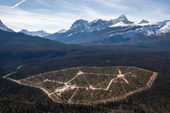
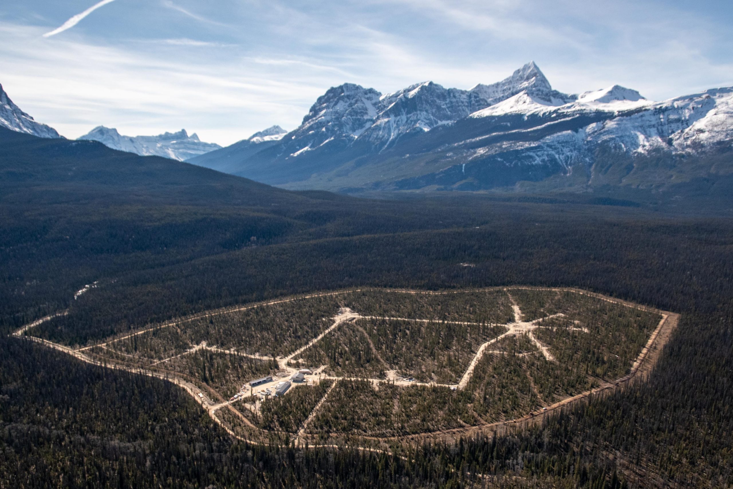
Lobelia Subdivision and Lobelia Drive Upgrades

Lobelia Subdivision and Lobelia Drive Upgrades 202-22 | Osoyoos, BC The Lobelia Subdivision and Lobelia Drive Upgrades marked the conversion of a 3.24-acre family fruit farm, operational since the 1970s, into a thriving 15-lot single-family home community. In the spring of 2018, the Mackay family, who had recently inherited the family farm, faced the dilemma…

Autonomous LiDAR Drone for Tunnel Inspection: Mapping the Unknown

Inside a mountain in the Kitimat Ranges on BC’s northwest coast is a 475-metre long, 8-metre wide “tailrace” tunnel that transports the outflow water from the hydroelectric generation station in the mountain. The client, Rio Tinto, required a detailed interior survey of the tunnel for ongoing maintenance purposes and the tailrace could not be shut down for inspection. McElhanney provided bathymetric survey expertise to launch an autonomous drone mission that captured 3D scans of the tunnel interior to provide the client with the high-definition data they required for the structure.

Progress Energy Asset Management

McElhanney was retained by Progress Energy for the purpose of asset management/inventory. McElhanney split the asset management project into 3 phases; (1) project initiation and development of Vertisee, an online web-based map to sort and file information collected on roads, bridges and other assets; (2) data acquisition and management; and (3) ongoing updates.

Prince Rupert Gas Transmission Project

The Prince Rupert Gas Transmission Project (PRGTP) is a proposed 900 kilometre natural gas pipeline running from Hudson’s Hope to Lelu Island on the BCs North Coast. This project involved extensive digital data collection in the field using the latest technology and continual updates to Vertisee, McElhanney’s own web-based GIS mapping platform.

Grizzly Bear & Moose Mapping

2009 | Remote Northern BC – The Government of BC hired McElhanney to head into the deep backcountry of the Skeena-Stikine and Kitimat regions. Our job was to identify critical bear habitat, along with important wintertime feeding areas for local moose populations and record our discoveries through mapping.