
Lake Babine Nation Memorandum of Understanding
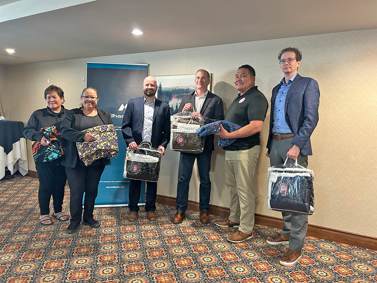
After months of discussion, McElhanney and Lake Babine Nation signed an MOU to guide future work together.
After months of discussion, McElhanney and Lake Babine Nation signed an MOU to guide future work together.
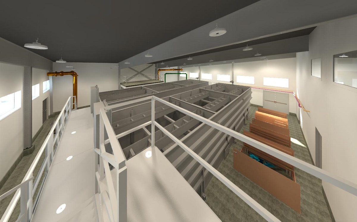
Requirements to meet provincial water treatment objectives motivated the District to upgrade to a new potable water treatment plant.
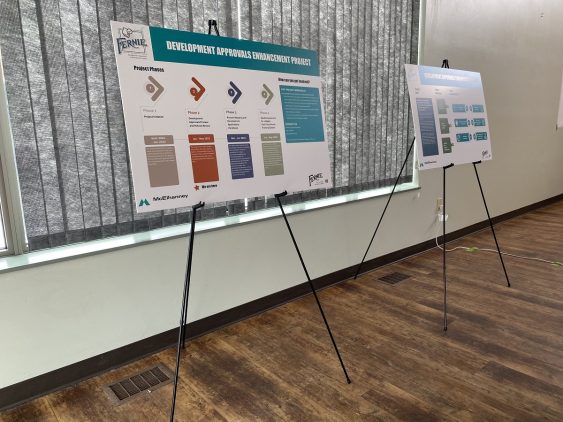
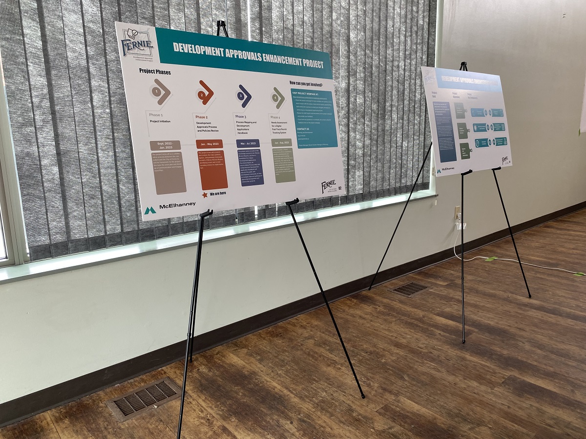
The City’s development approval enhancement project created a more efficient, transparent, and responsive development approval system.
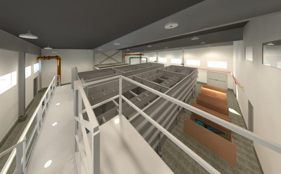
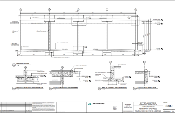
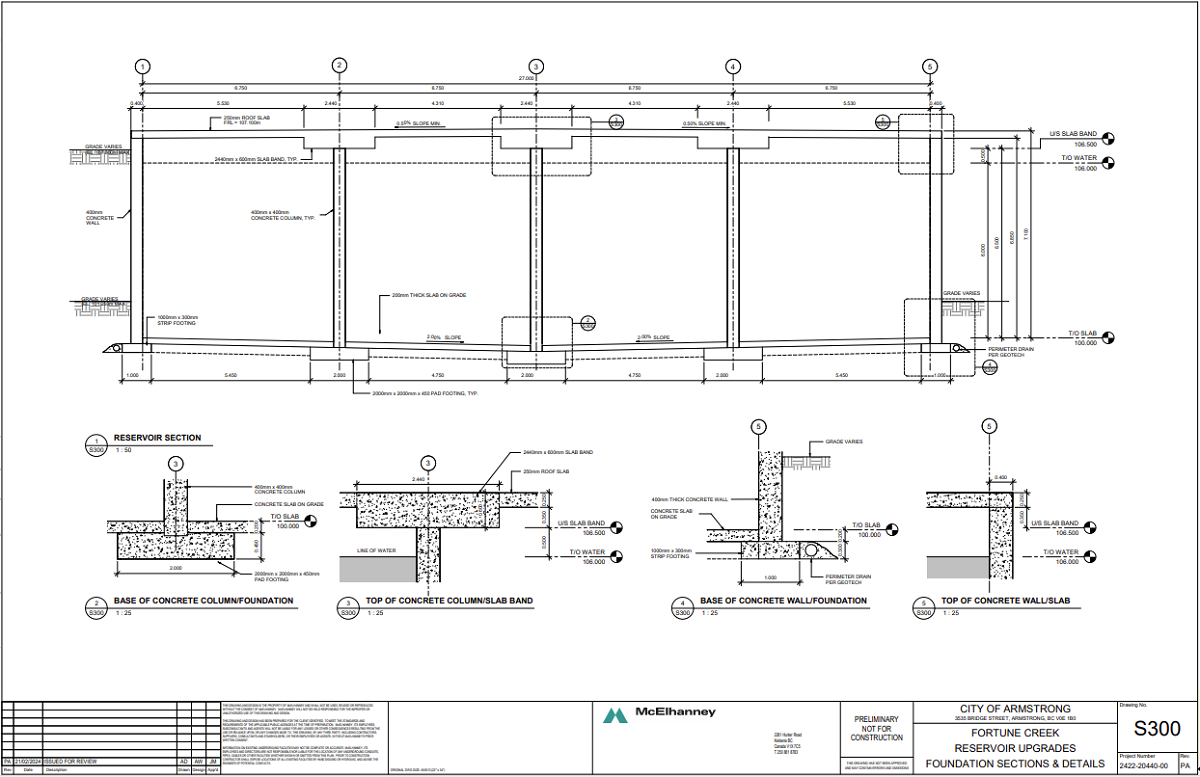
To address an existing water storage deficiency, the City of Armstrong requested a design for concrete potable water reservoirs.
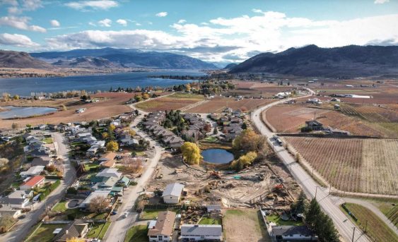
Lobelia Subdivision and Lobelia Drive Upgrades 202-22 | Osoyoos, BC The Lobelia Subdivision and Lobelia Drive Upgrades marked the conversion of a 3.24-acre family fruit farm, operational since the 1970s, into a thriving 15-lot single-family home community. In the spring of 2018, the Mackay family, who had recently inherited the family farm, faced the dilemma…
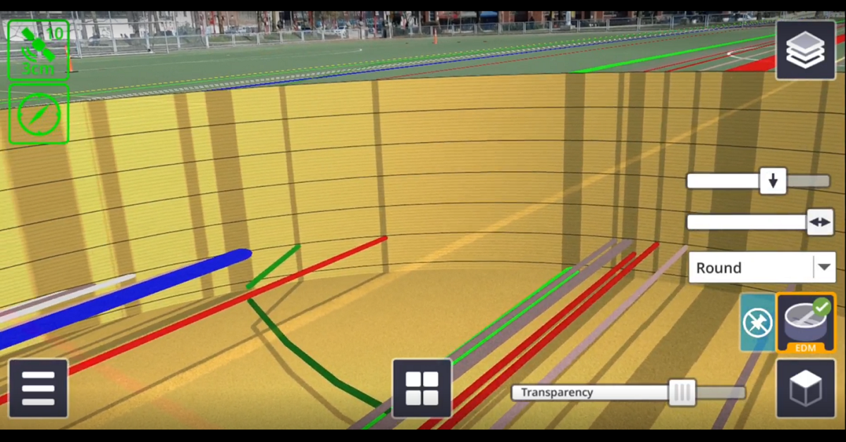
There are numerous applications for Trimble SiteVision, from underground utility exploration to aboveground boundary overlays.
Smithers maintained a strong mountain town identity and sense of place, and wanted future growth to be managed by an OCP that respected community values.
McElhanney delivered digital engagement services and kept communication channels open without relying on physical meetings.
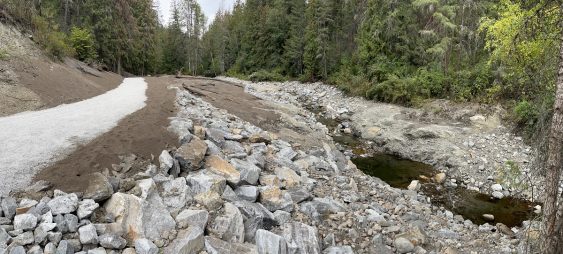
With the dam set to expire as a sediment pond, RDNO focused on decommissioning the facility and returning the creek to a natural state.
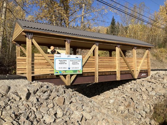
Combining over 6km of paved and accessible multi-use trails, the Fernie Valley Pathway is a robust, multi-modal transportation system.


