Stoney Creek Park Trail System
To support Stoney Creek Park trail system development, Camrose received grant funding to establish a Trail Master Plan for the Stoney Creek Valley.


Land Developers, various levels of government, First Nations groups and resource companies use Vertisee to manage, monitor, and analyze their assets. Whether your expertise is project management, planning or engineering, Vertisee allows you to seamlessly share spatial geographic information on any internet browser in a user-friendly interface. A game-changer for project planning, tracking and the management of spatial data both within the office or in the field, common applications include asset management, transportation monitoring and analysis, and emergency and disaster management.
Vertisee can accommodate any type of data that can be placed on a map; including roads, pipes, buildings, vegetation, cadastral lot plans, environmental features, and events.
Customize your web map with tools that save you time, and features to make accessing information straightforward.

Customize your web map with tools and features to make viewing information a breeze.


Vertisee data is always current as it resides on in-house cloud servers within Canada and provides real-time updates of project information. Monitor the progression of your field crews as they collect and manage data throughout your project. Access all your data on the go live using mobile GPS-enabled devices, including tablets and smartphones.
Use Vertisee to share data with your staff, clients, partners, or the public. Host your data on Vertisee with password protection or open it up to the public to see and interact with all stakeholders.

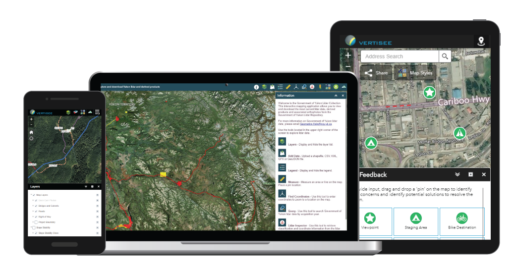
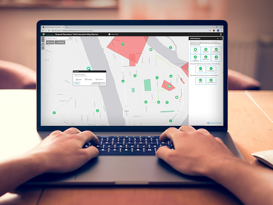
Connect with your stakeholders. Vertisee can be used on a variety of platforms: from desktop computers to tablets to mobile devices. Vertisee’s robust tool set can be customized for different use-cases, making it an ideal tool for community engagement. When configured as a community engagement interface, Vertisee allows the public to view data at their convenience and provide feedback directly from their electronic device. Engage, share, take action.

Need LiDAR and / or orthophotography? Check out our extensive LiDAR and orthophotography catalogue.
To support Stoney Creek Park trail system development, Camrose received grant funding to establish a Trail Master Plan for the Stoney Creek Valley.
In 2020, KFN embarked on a multi-year improvement program to help them do their infrastructure management business in a different way.
Because of the Watson Island Redevelopment Project, the Prince Rupert community has witnessed a new beginning for the site of a former pulp mill.
McElhanney’s in house web mapping platform, Vertisee, was used to host all of the relevant project information including current and historical assets, orthophoto, LiDAR and field crew assessments.
McElhanney deployed Vertisee, its own web-based mapping solution, and developed a tool within it which allowed multiple consultant / subcontractors to submit work simultaneously during the Highway 1 road upgrades.
McElhanney’s GIS system, Vertisee, was used to identify potential land use conflicts and synergies, for a land use plan as part of the implementation of the First Nations Land Management Act for Haisla First Nation.
McElhanney designed and implemented a mobile field program and desktop conversion of various data sources to update Metro Vancouver Regional District’s spatial database of all assets owned and maintained by the Parks department.
“Vertisee has been an extremely useful tool in compiling all of our data into a user-friendly and intuitive interface for analysis and planning purposes. It provides a single source for up-to-date asset inventory and management information, as well as a holistic view of our operating environment at Parks Canada. It has been instrumental in the delivery of numerous capital projects and asset inspection programs.”
“McElhanney’s Vertisee and Vertisee crowdsource tools have been invaluable to our projects and our clients. They enable fun and easy sourcing of spatial and qualitative input from the public, stakeholders and clients and promote an effective online discussion between engagement participants. The input is essential to our co-creation and design projects. The platform runs reliably, and McElhanney’s GIS team are fantastic to work with – timely, professional and reliable.”
“I spent some time familiarizing myself with Vertisee. Pretty cool and very user friendly, and great to finally see this information become centralized. It will be interesting to see the layers grow and the connection possibilities once all mapping information has been added.”
“A secure internal GIS web portal (Vertisee) provides interactive views of the utilities composite map. The ability to visualize the utility systems improved communications in project teams and added institutional capacity to quantify needs for long term capital planning.”
“Requests from project managers for utilities information that in the past took up to 3 days, now takes a matter of seconds to compile. Through ViewSFU (GIS site) and Vertisee (GIS web portal), custom queries that required filtering and asset ID search would have required up to 3 hours, are now completed in less than 5 minutes.”
Your time is your greatest asset – contact our GIS team to find out how Vertisee can give more of it back to you.
 Secure Project Log-in
Secure Project Log-in
Secure Project Log-in