On May 12, 2023, the McElhanney geomatics team chalked up national recognition with a prestigious national award for a project that shows how the latest in automated drone technology can help clients keep their people safe and reduce environmental impact.
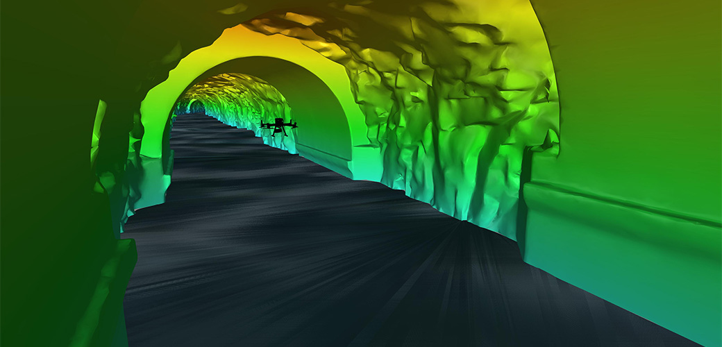
At their annual conference, the Association of Canada Lands Surveyors and Professional Surveyors of Canada jointly honoured McElhanney as the winner for the award in the Challenging Non-Cadastral Survey Project category. The award honours the project submission, Mapping the Unknown: Autonomous LiDAR Drone Tunnel Inspection of the Rio Tinto Tailrace, about the meticulous mission that sent an autonomous drone to fly almost 500 metres into a tailrace tunnel in a mountain to capture high-resolution, 3D scans of the tunnel interior while four-metre-deep outflow water raced beneath it.
Accepting the award on the team’s behalf, Jim Christie, McElhanney Vice President of Geomatics & Geospatial, Vancouver Region: “What an honour. Kudos to our client, Rio Tinto, who placed their trust in our exceptional team, led by Project Manager Marcell Iseli, to use this advanced technology and relatively new equipment to deliver the best results for the client.”
This is the third year in a row that the McElhanney team was chosen from among submissions across Canada for this national recognition for “projects that exemplify the innovation and contribution to society that surveyors make every day to bring successful projects about for the betterment of all Canadians” (David Thompson Award website; there were no awards in 2021 due to the COVID-19 pandemic.)
Watch the video on the project:
Learn more:
- The Association of Canada Land Surveyors’ David Thompson Awards
- The story behind the winning project on our website, Autonomous LiDAR Drone for Tunnel Inspection: Mapping the Unknown.
Get to know more about related McElhanney services:
- Geomatics (Survey)
- GIS and Remote Sensing