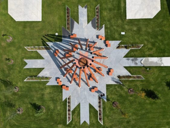
Fort McMurray #468 First Nation Welcome Sign and Firepit Structure
McElhanney contributed to a firepit structure and a welcome sign, both of which were designed to honor the land, for Fort McMurray #468 First Nation.
McElhanney contributed to a firepit structure and a welcome sign, both of which were designed to honor the land, for Fort McMurray #468 First Nation.
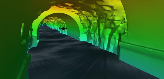
Inside a mountain in the Kitimat Ranges on BC’s northwest coast is a 475-metre long, 8-metre wide “tailrace” tunnel that transports the outflow water from the hydroelectric generation station in the mountain. The client, Rio Tinto, required a detailed interior survey of the tunnel for ongoing maintenance purposes and the tailrace could not be shut down for inspection. McElhanney provided bathymetric survey expertise to launch an autonomous drone mission that captured 3D scans of the tunnel interior to provide the client with the high-definition data they required for the structure.
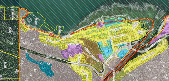
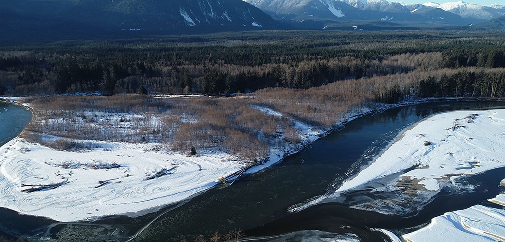
This project began as other flood mapping projects do: the existing flood maps were from 1982 and the District of Kitimat knew that they required an update.
McElhanney’s in house web mapping platform, Vertisee, was used to host all of the relevant project information including current and historical assets, orthophoto, LiDAR and field crew assessments.
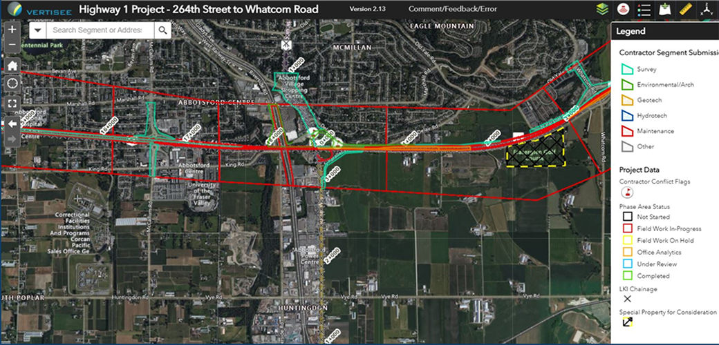
McElhanney deployed Vertisee, its own web-based mapping solution, and developed a tool within it which allowed multiple consultant / subcontractors to submit work simultaneously during the Highway 1 road upgrades.
McElhanney’s GIS system, Vertisee, was used to identify potential land use conflicts and synergies, for a land use plan as part of the implementation of the First Nations Land Management Act for Haisla First Nation.
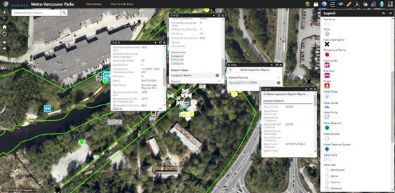
McElhanney designed and implemented a mobile field program and desktop conversion of various data sources to update Metro Vancouver Regional District’s spatial database of all assets owned and maintained by the Parks department.
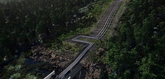
McElhanney’s multi-disciplinary team leveraged their professional expertise on multiple projects for the Attachie / Altares Development.
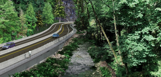
With the Malahat Corridor Improvement Project, the BC Ministry of Transportation & Infrastructure has been improving the safety of Hwy 1 by installing a median barrier and other upgrades. The stretch of highway which runs through Goldstream Provincial Park is challenging to design solutions for, as it is constrained by the river immediately running next to it, and by park lands on both sides.
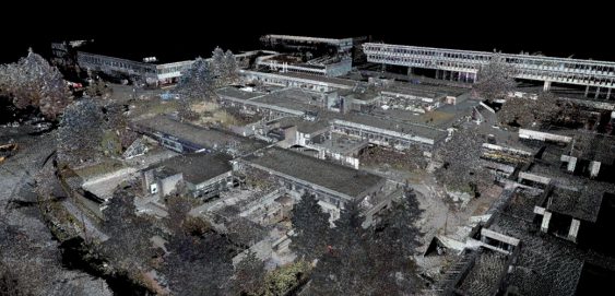
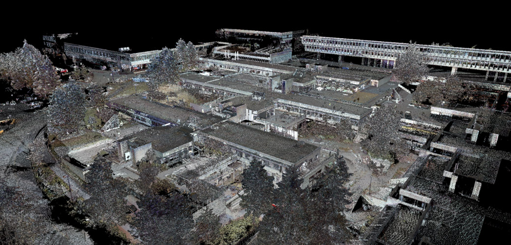
Burnaby, BC – McElhanney conducted several laser scan surveys at SFU to assist with a variety of renovation and upgrade projects. Our team of modelling technicians converted the resulting point cloud exports into 3D Building Information Models (BIM) which are used directly by the architectural project team.

