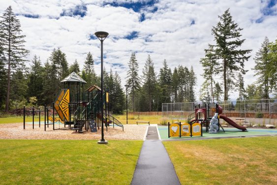
K’ómoks First Nation Community Park
KFN members had no accessible, outdoor gathering space to meet, celebrate, gather, and play. Could a Canada Community Revitalization Fund grant meet their need?
3
KFN members had no accessible, outdoor gathering space to meet, celebrate, gather, and play. Could a Canada Community Revitalization Fund grant meet their need?
Tofino’s successful Housing Accelerator Fund application and subsequent planning support their objective to increase multi-family housing development.
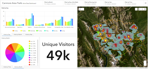
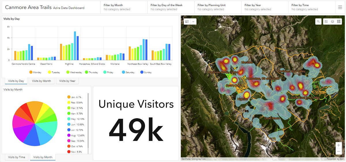
By leveraging big data to understand trail user trends, McElhanney teams are helping trail groups and clubs make sustainable long-term plans.
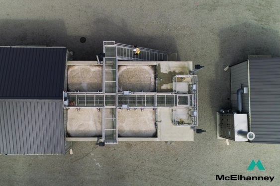
Upgrading and improving Mill Bay’s wastewater treatment accommodated future growth and minimized system complexity.
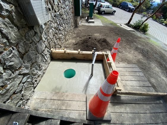
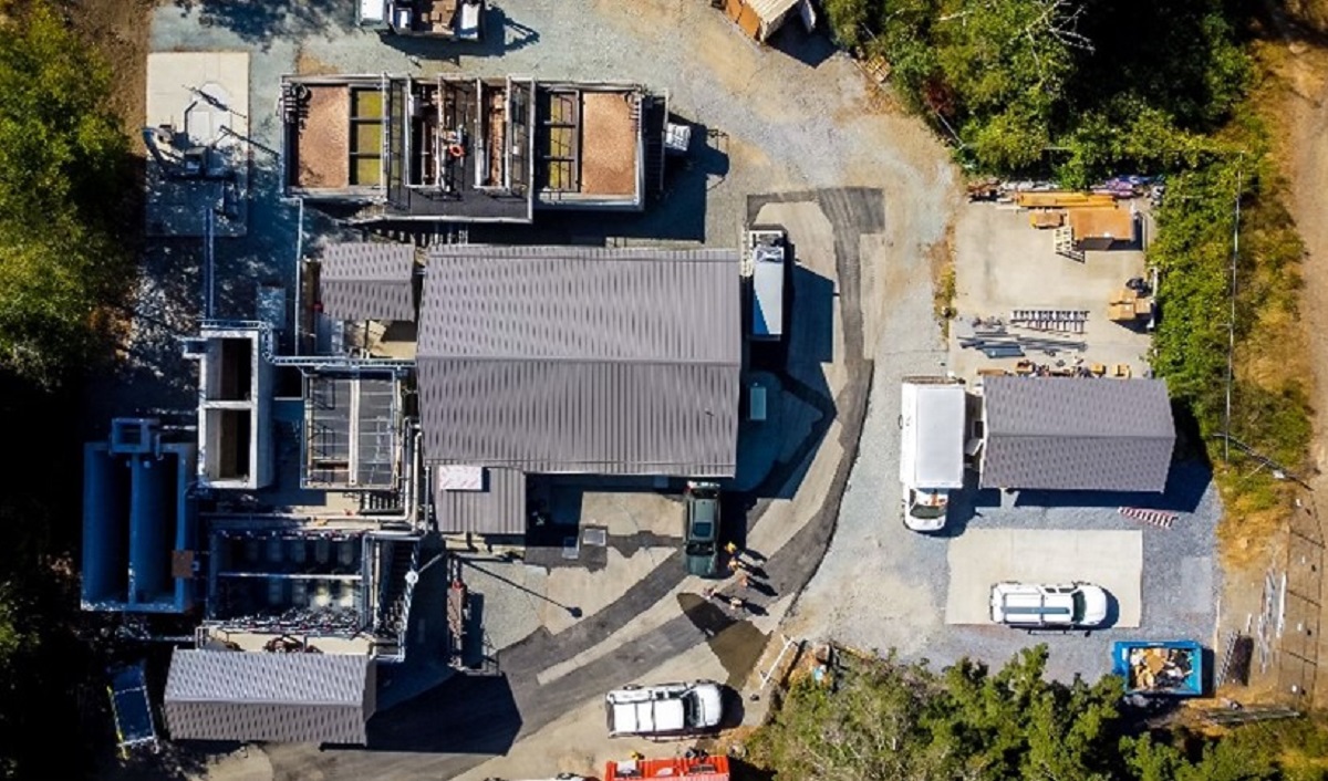
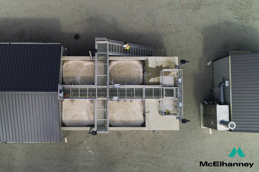
Huu-ay-aht First Nations required a new wastewater management system for the expansion of the Anacla community.
McElhanney provided design and construction services to provide reservoir valve upgrades at Walfred Reservoir.
The City of Duncan’s reservoir replacement had to store twice the amount of water on a parcel the size of a basketball court. Could our design deliver?
To support BC MoTI’s Resilient Highway Infrastructure Adaptation Program, we developed a system to identify, analyze, and map at-risk culverts province-wide.
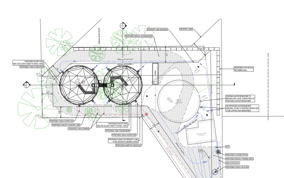
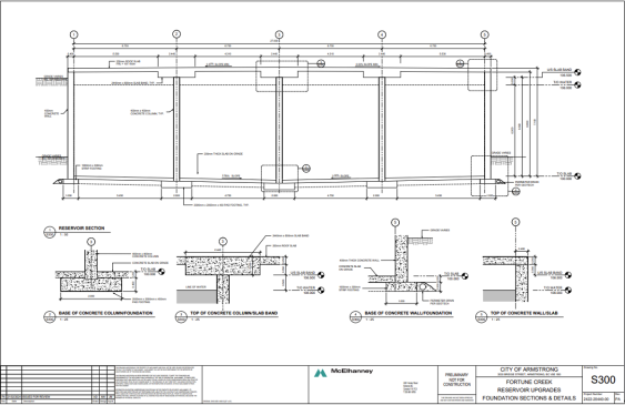
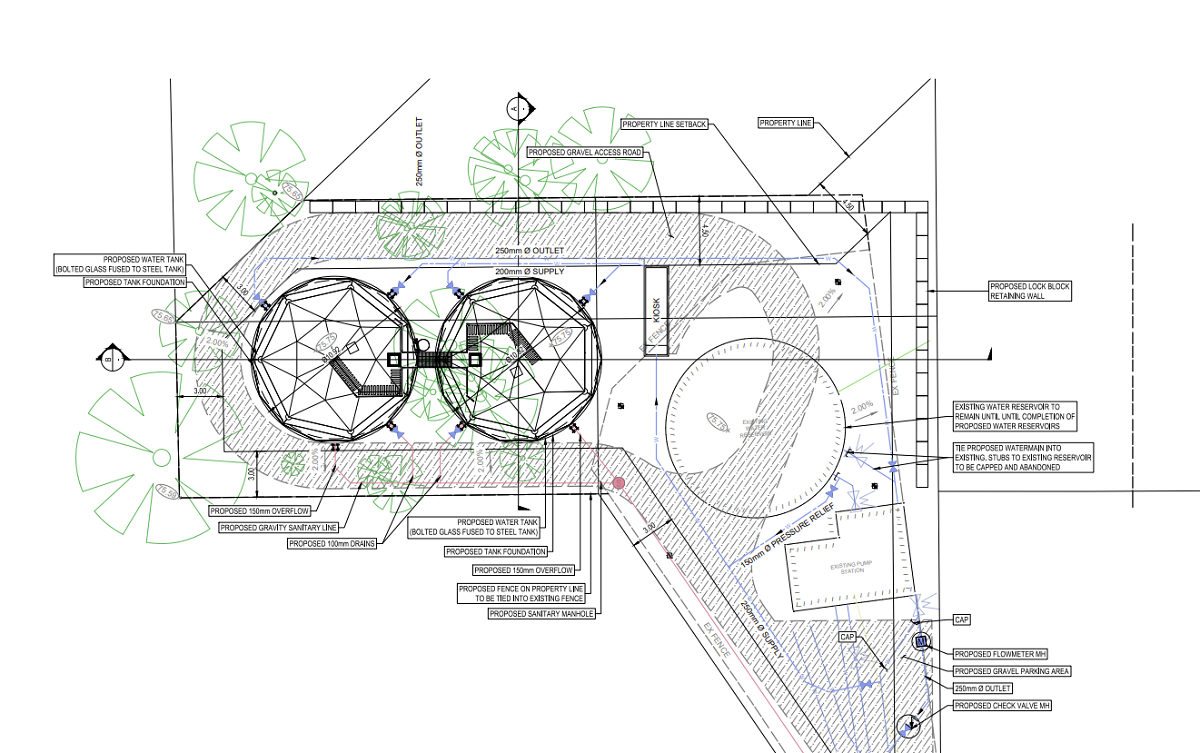
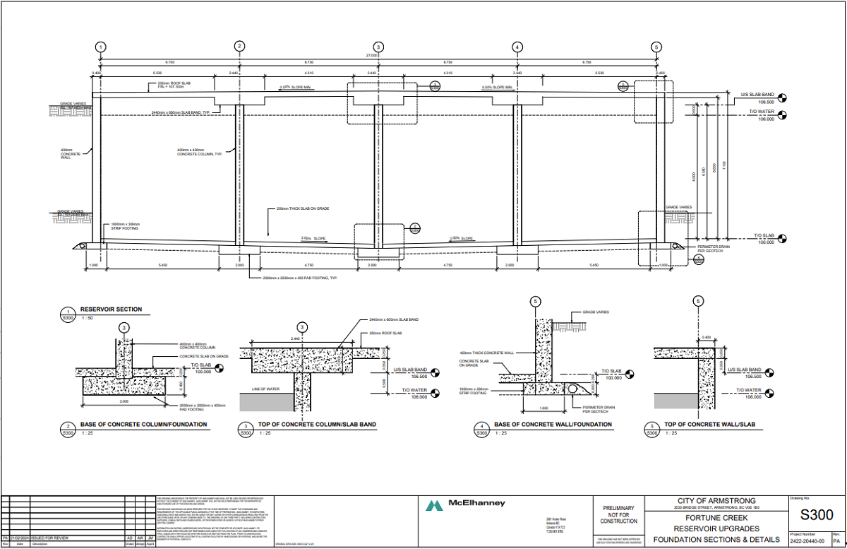
To address an existing water storage deficiency, the City of Armstrong requested a design for concrete potable water reservoirs.
McElhanney led a team of civil, process mechanical, structural, geotechnical, and electrical disciplines in the Wakefield lift station replacement.


