
CRD Nature-Based Recreation
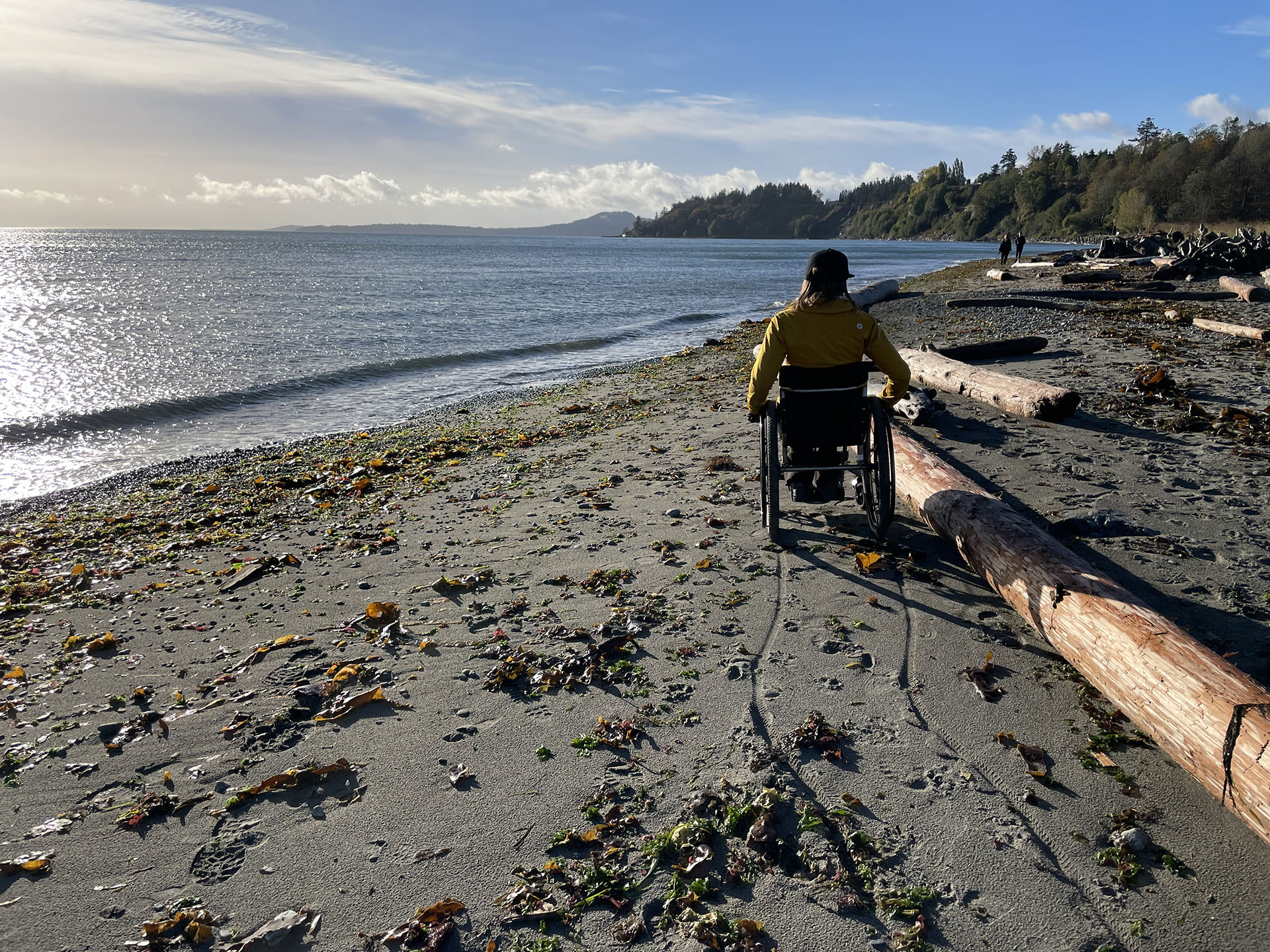
The CRD identified gaps and made recommendations to create more accessible nature-based outdoor recreation opportunities in their community.
The CRD identified gaps and made recommendations to create more accessible nature-based outdoor recreation opportunities in their community.
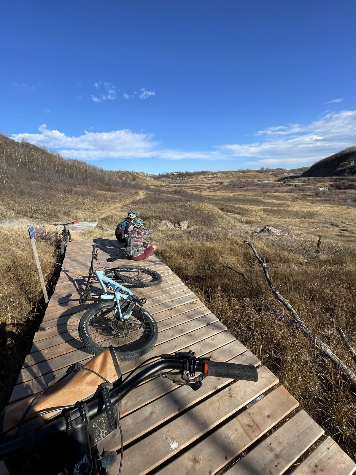
To support Stoney Creek Park trail system development, Camrose received grant funding to establish a Trail Master Plan for the Stoney Creek Valley.
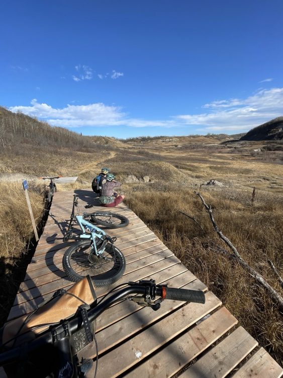
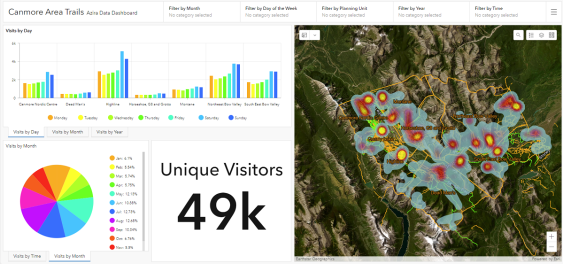
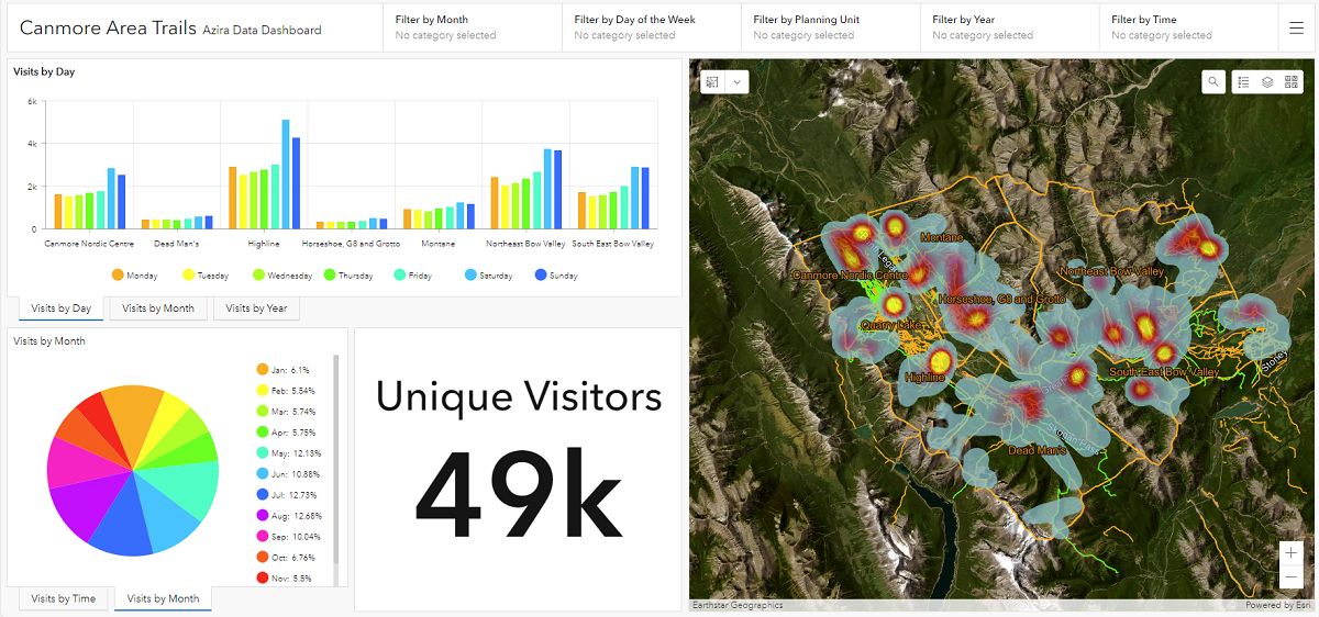
By leveraging big data to understand trail user trends, McElhanney teams are helping trail groups and clubs make sustainable long-term plans.
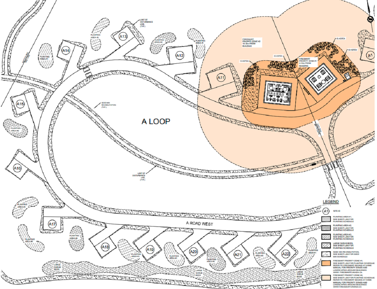
After it was destroyed by wildfire in 2017, McElhanney was engaged to deliver a FireSmart strategy for Crandell Mountain Campground.
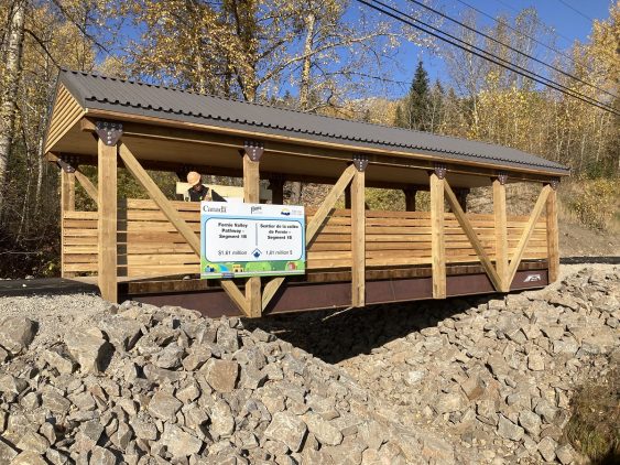
Combining over 6km of paved and accessible multi-use trails, the Fernie Valley Pathway is a robust, multi-modal transportation system.
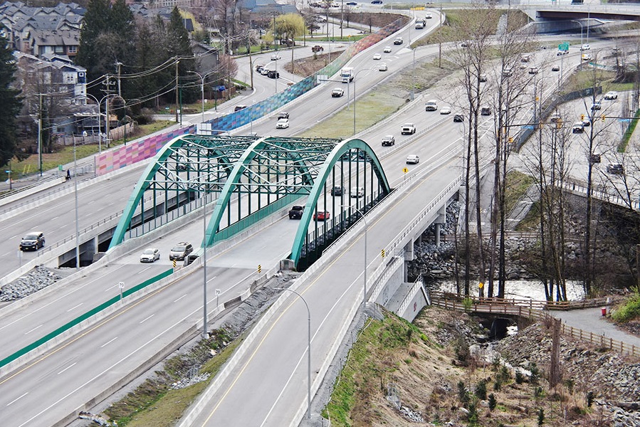
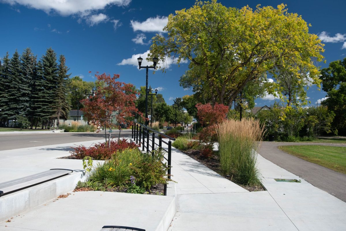
Award-winning work within a constrained, congested corridor that included fish-bearing creeks, sensitive habitat, parks, residences, and commercial spaces.
A trail featuring lake views, grasslands, and shorebird habitats, McElhanney was proud to be involved with the Kinbrook Connection Pathway.
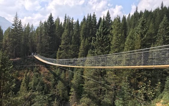
Blackshale Creek Bridge provides a special experience on the High Rockies Trail and allows users to avoid the steep creek bed.
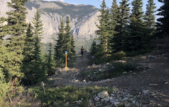
As the popularity of the Yamnuska recreation area grew over recent years, so did the number of rescues. Could improved trails reduce risk?
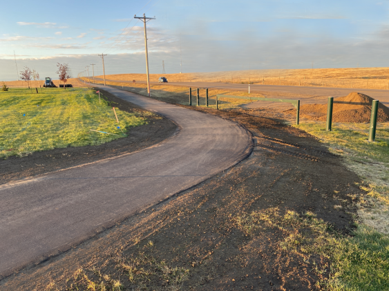
Integrating a Transportation Master Plan with an Urban Framework Master Plan opened the door for multiple improvements to be made in tandem.


