
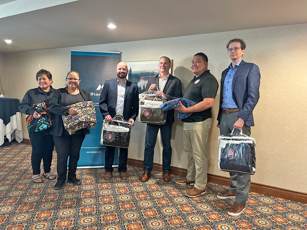
Lake Babine Nation Memorandum of Understanding
After months of discussion, McElhanney and Lake Babine Nation signed an MOU to guide future work together.
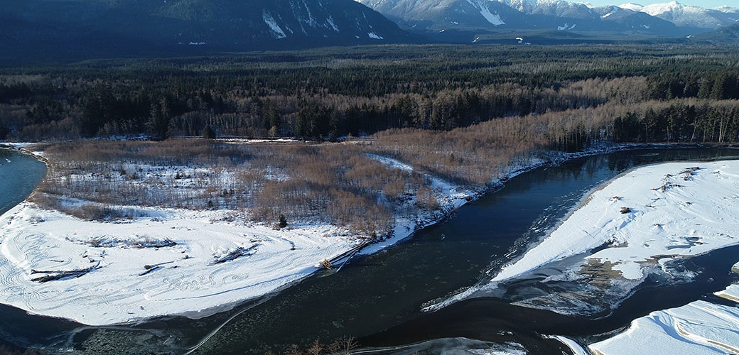
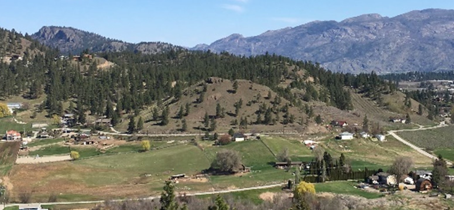
Explore projects we’ve completed in British Columbia’s northern, interior, and central regions, from the Okanagan Valley and Fort Nelson to the Skeena-Stikine.
After months of discussion, McElhanney and Lake Babine Nation signed an MOU to guide future work together.
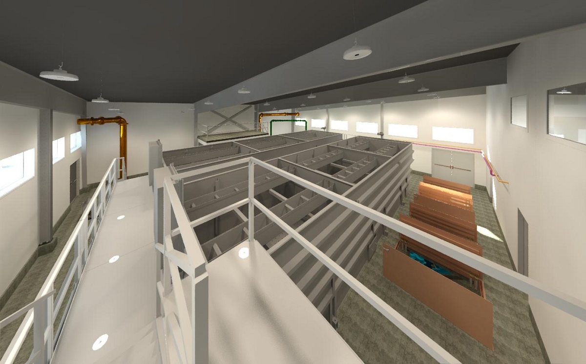
Requirements to meet provincial water treatment objectives motivated the District to upgrade to a new potable water treatment plant.
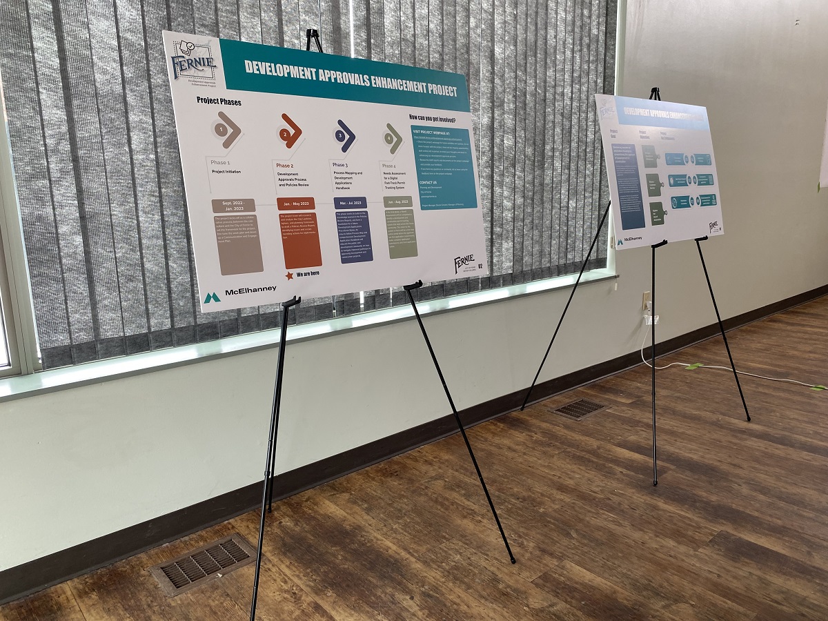
The City’s development approval enhancement project created a more efficient, transparent, and responsive development approval system.
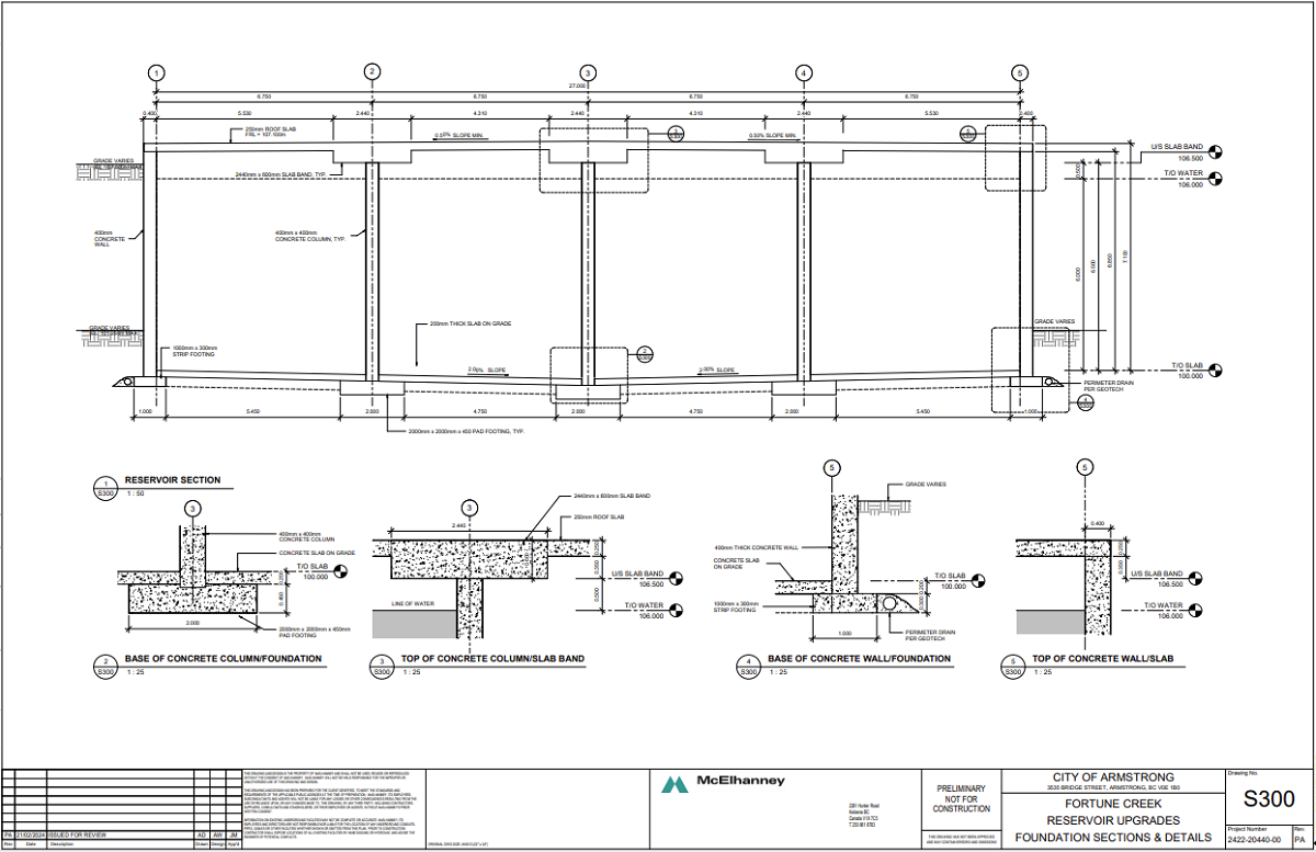
To address an existing water storage deficiency, the City of Armstrong requested a design for concrete potable water reservoirs.
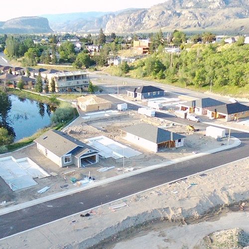
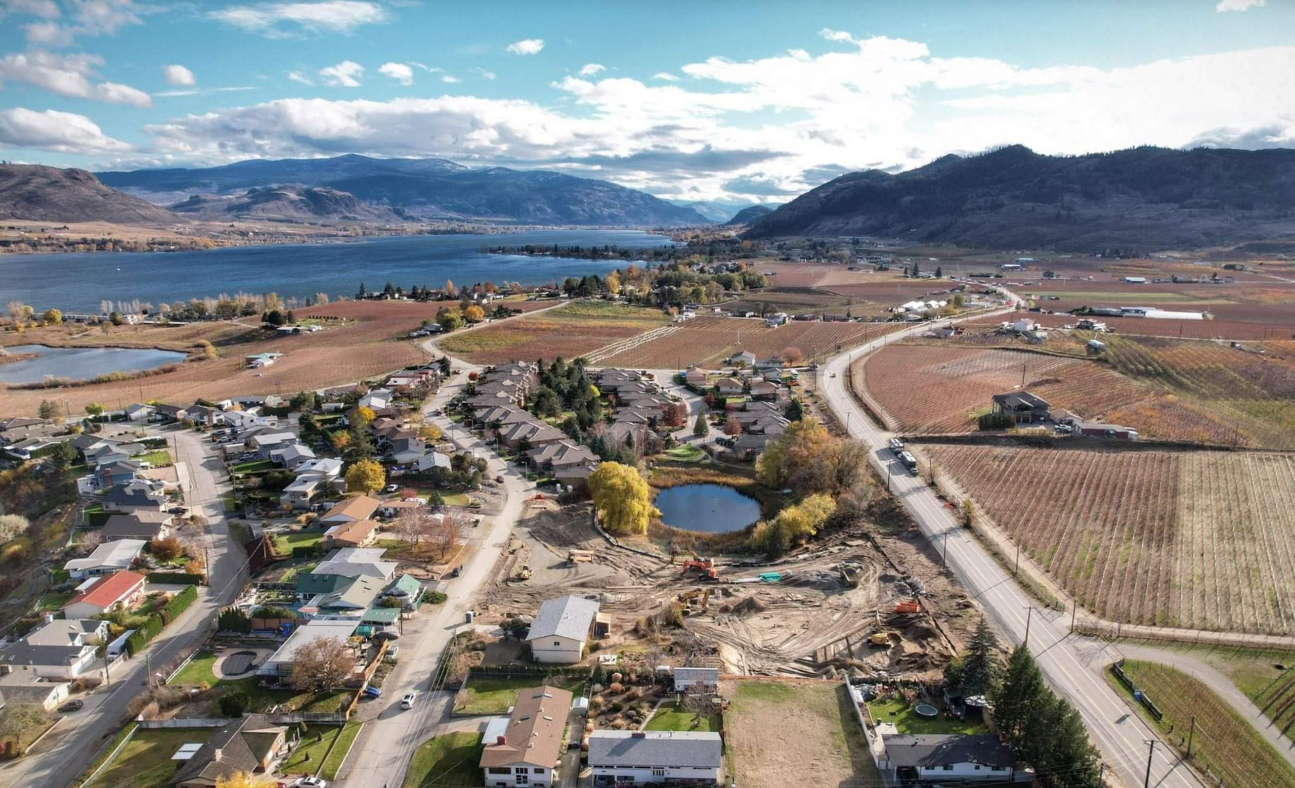
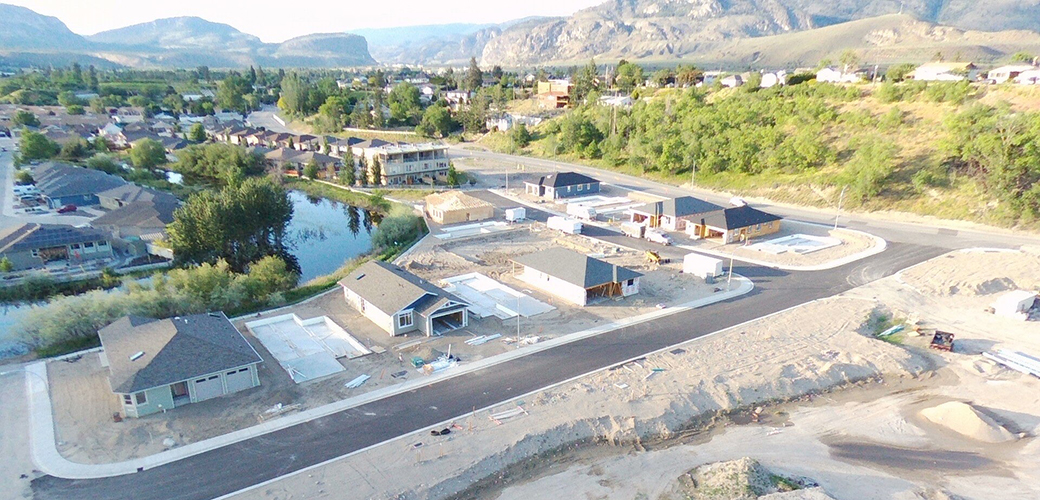
Lobelia Subdivision and Lobelia Drive Upgrades 202-22 | Osoyoos, BC The Lobelia Subdivision and Lobelia Drive Upgrades marked the conversion of a 3.24-acre family fruit farm, operational since the 1970s, into a thriving 15-lot single-family home community. In the spring of 2018, the Mackay family, who had recently inherited the family farm, faced the dilemma…
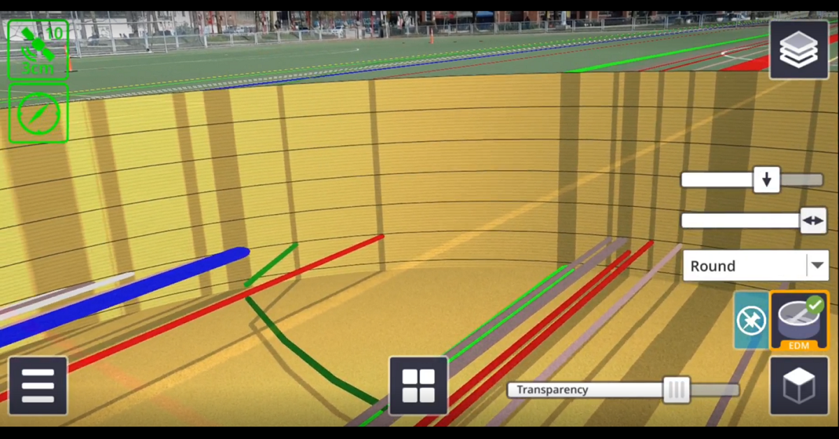
There are numerous applications for Trimble SiteVision, from underground utility exploration to aboveground boundary overlays.
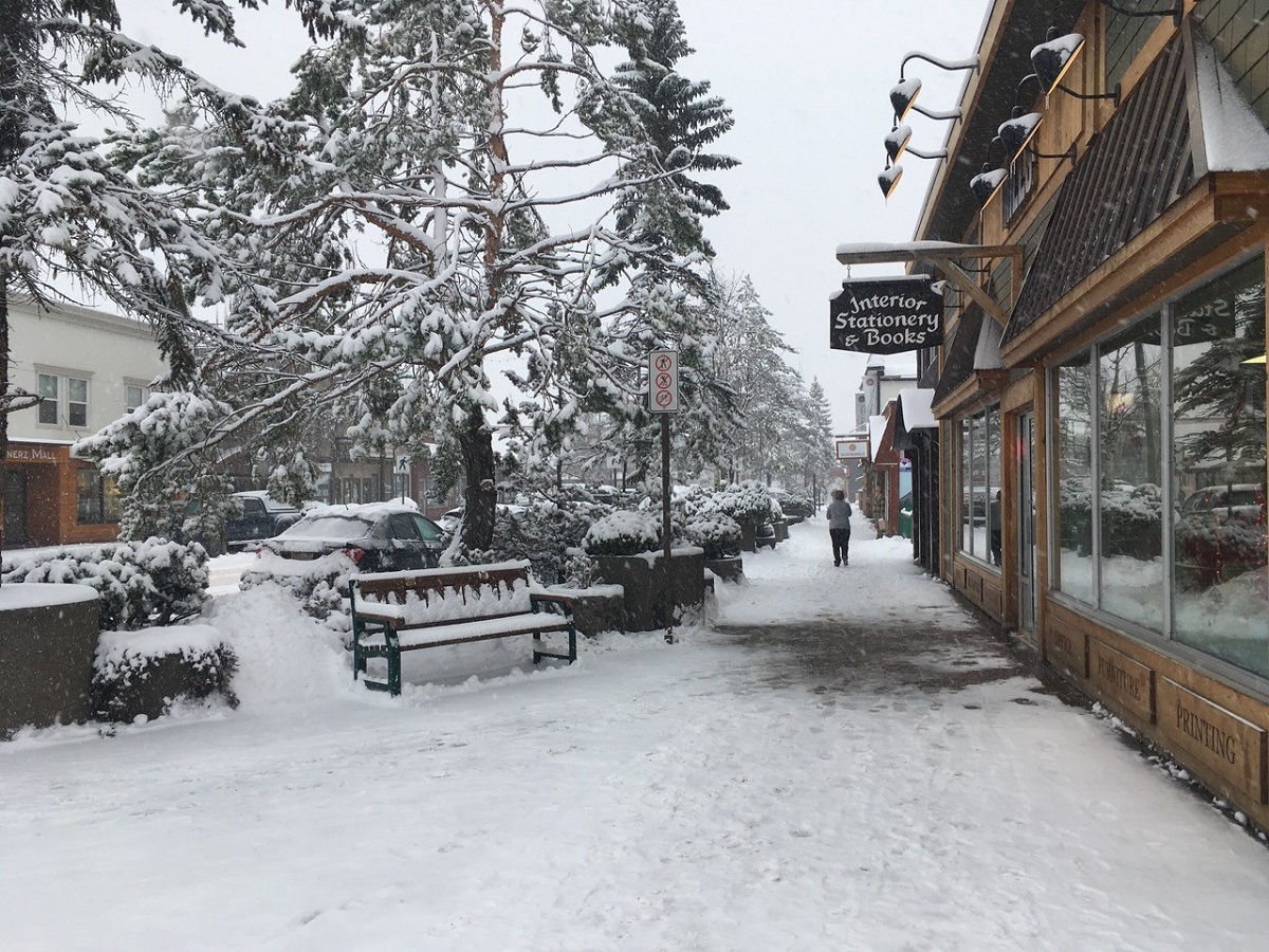
Smithers maintained a strong mountain town identity and sense of place, and wanted future growth to be managed by an OCP that respected community values.
McElhanney delivered digital engagement services and kept communication channels open without relying on physical meetings.
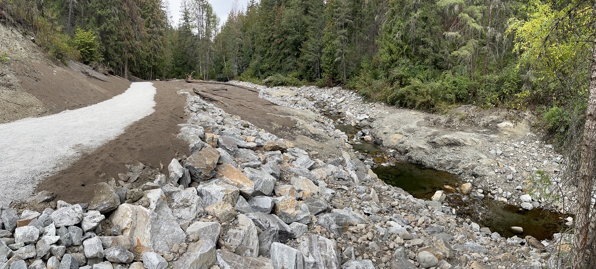
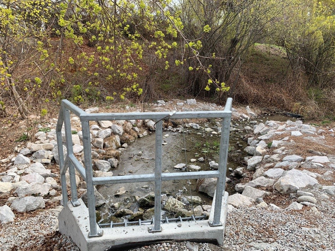
With the dam set to expire as a sediment pond, RDNO focused on decommissioning the facility and returning the creek to a natural state.
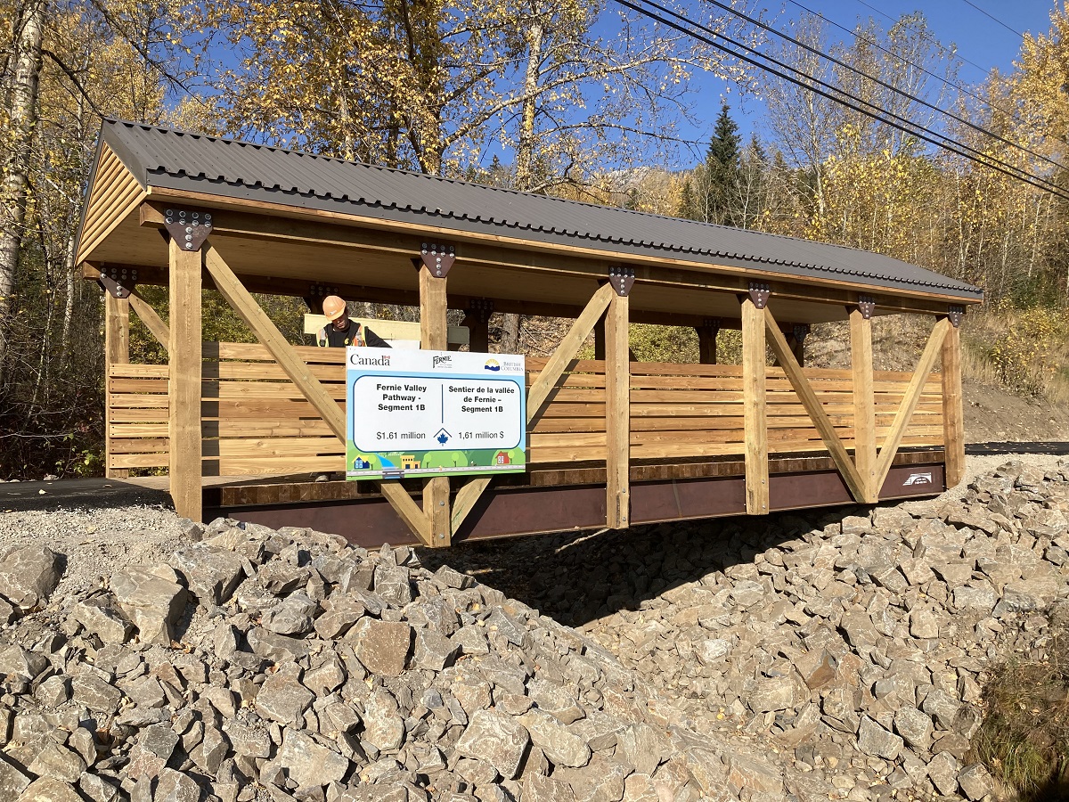
Combining over 6km of paved and accessible multi-use trails, the Fernie Valley Pathway is a robust, multi-modal transportation system.
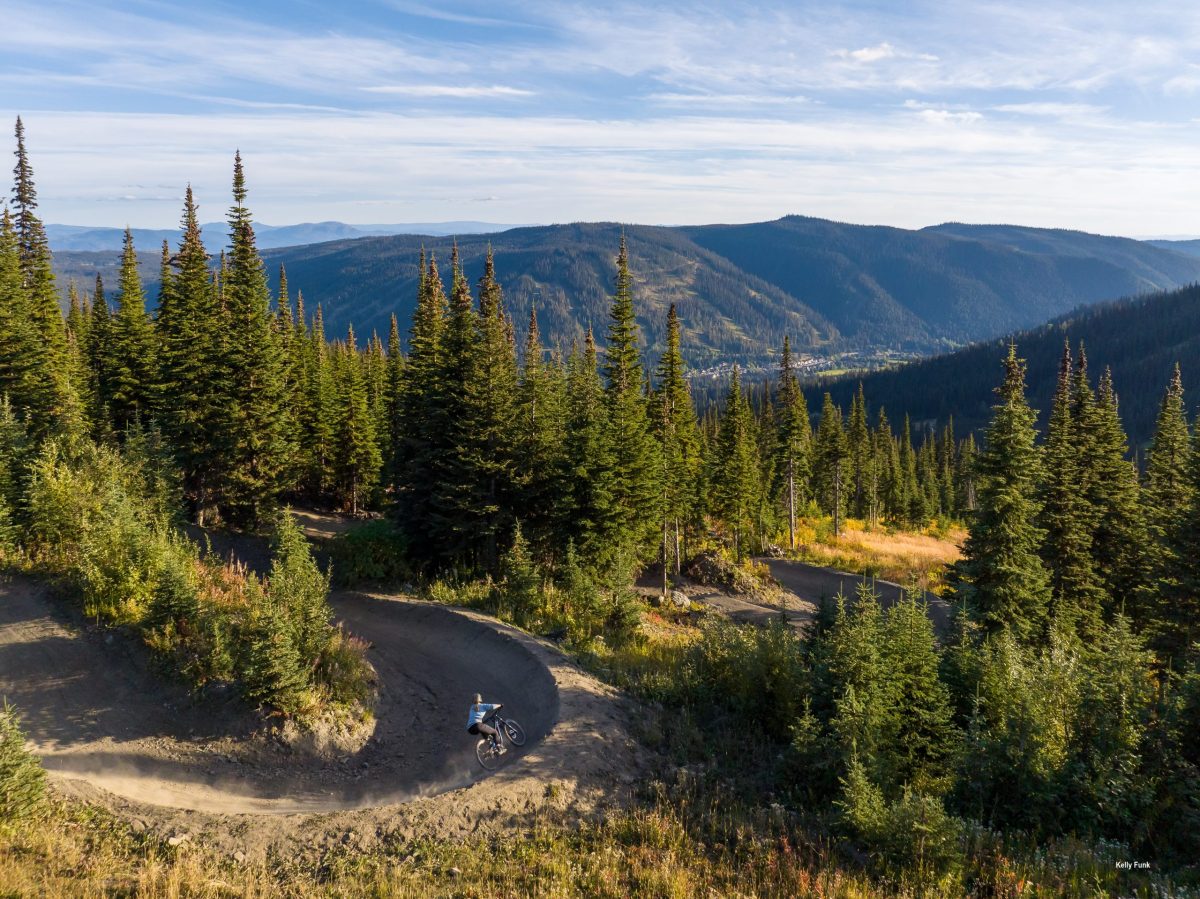
Sun Peaks Resort has staked its claim as a top year-round destination resort in Western Canada, and McElhanney is proud to contribute to that success.
The next logical step for the BC Powersports Coalition was the development of a best practices guide to inform development in BC.
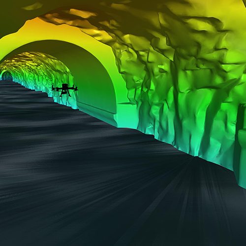
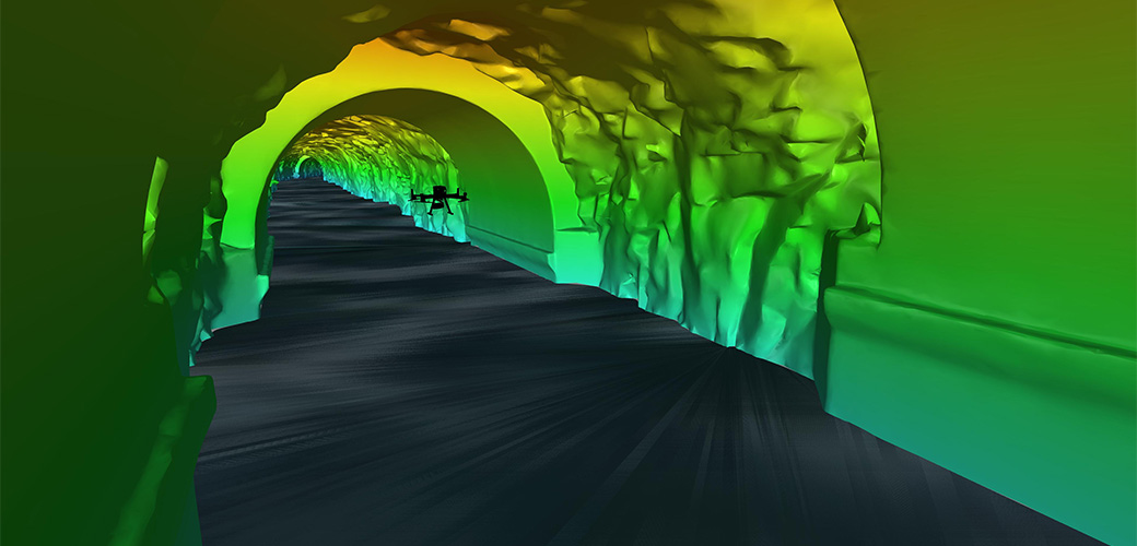
Inside a mountain in the Kitimat Ranges on BC’s northwest coast is a 475-metre long, 8-metre wide “tailrace” tunnel that transports the outflow water from the hydroelectric generation station in the mountain. The client, Rio Tinto, required a detailed interior survey of the tunnel for ongoing maintenance purposes and the tailrace could not be shut down for inspection. McElhanney provided bathymetric survey expertise to launch an autonomous drone mission that captured 3D scans of the tunnel interior to provide the client with the high-definition data they required for the structure.
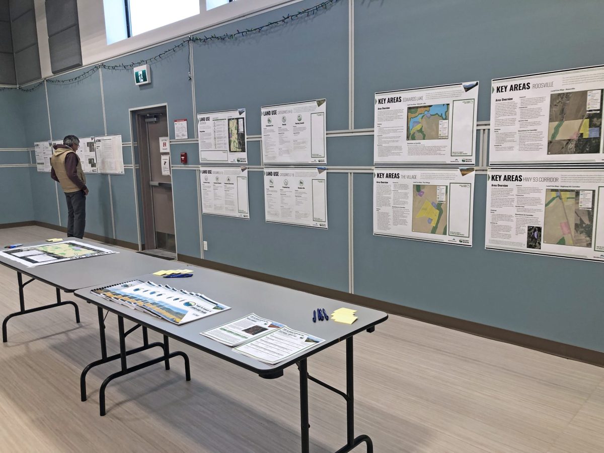
The Yaq̓it ʔa·knuqǂiʔit (Tobacco Plains) First Nation wished to create and implement a land use plan to meet the needs of its people.
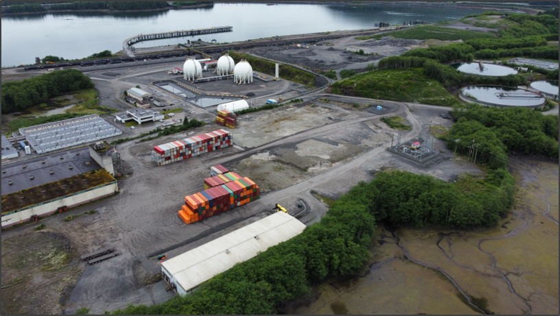
One of Western Canada’s largest container trade corridors, the Fairview Container Terminal in Prince Rupert, BC has experienced a boom in local export transload operations. As the terminal continues to grow, so too has the volume of traffic in Prince Rupert—it is estimated that the number of trucks travelling on Highway 16 has grown from 50 to 200 trucks per day.
This project began as other flood mapping projects do: the existing flood maps were from 1982 and the District of Kitimat knew that they required an update.
The Nisga’a Village of Gitwinksihlkw was ready for a Trail Master Plan and Detailed Design for their Saasak Hills Trail and River Walk.
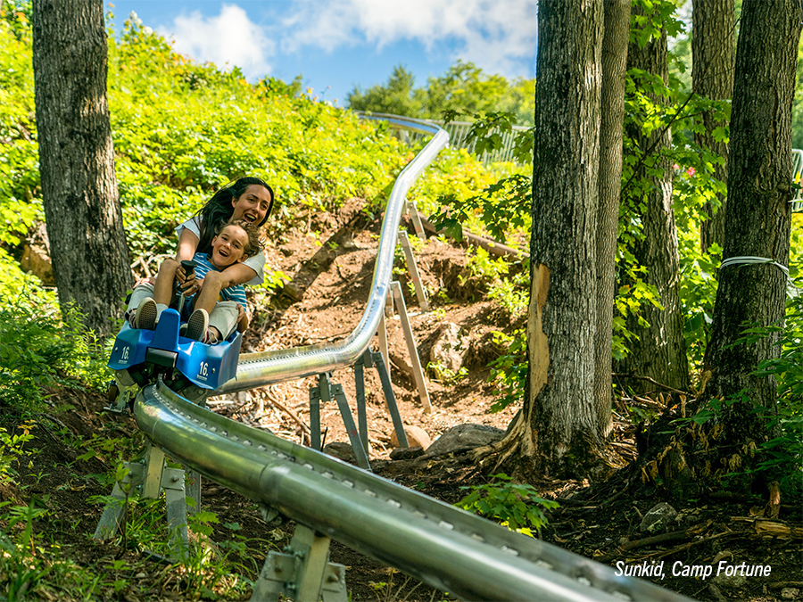
By expanding its summer operations to include a mountain coaster, Cypress Mountain aimed to further secure its reputation as a summer destination.
Because of the Watson Island Redevelopment Project, the Prince Rupert community has witnessed a new beginning for the site of a former pulp mill.
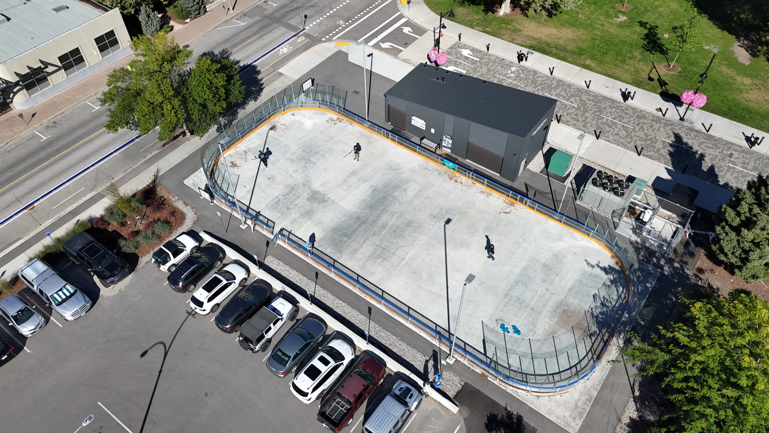
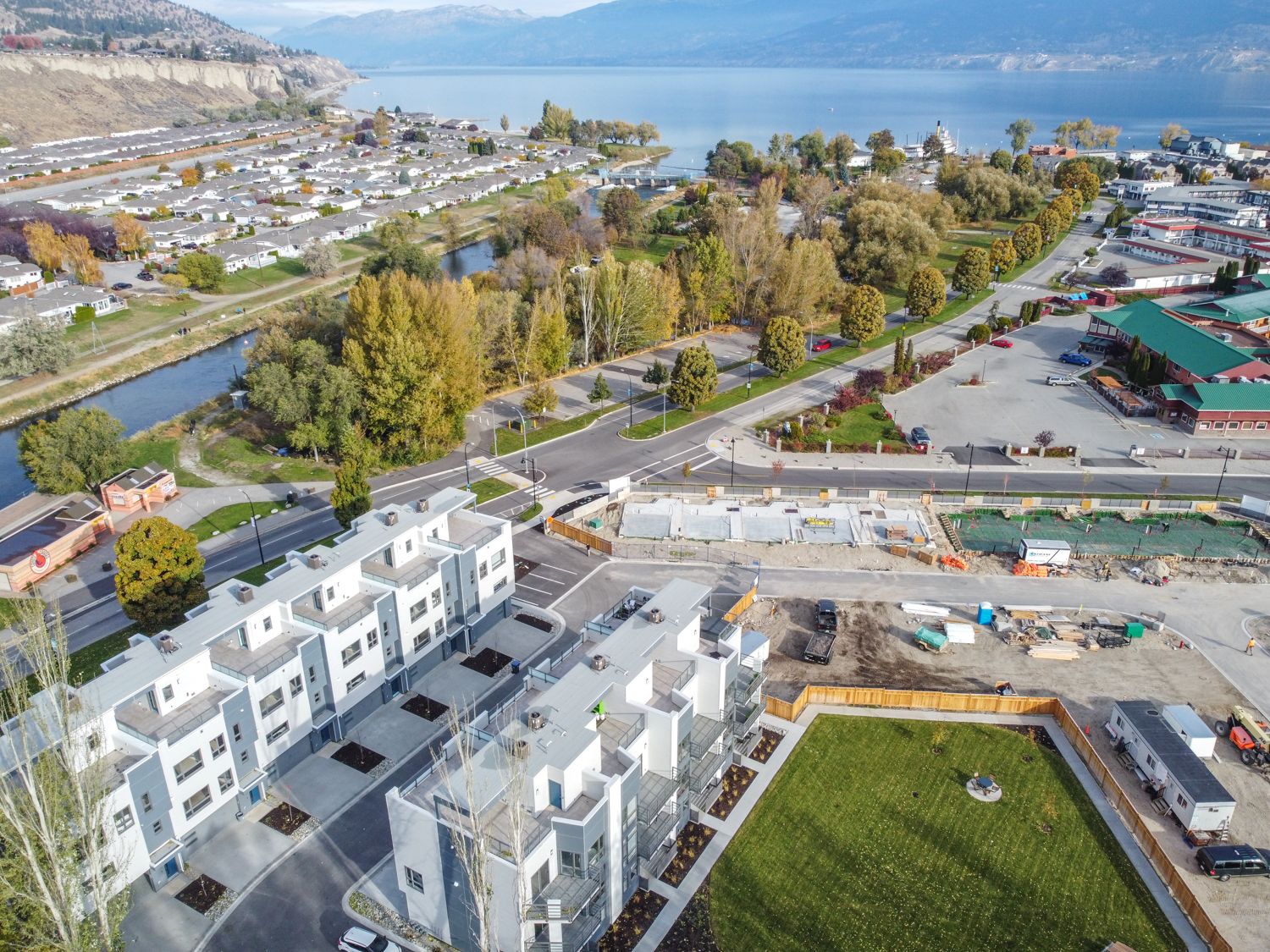
This free, outdoor, public skating rink in downtown Penticton would add vibrancy to the community. Could McElhanney be involved?
McElhanney’s province-wide presence and knowledge of local requirements offered a blend of expertise and familiarity that supported project success.
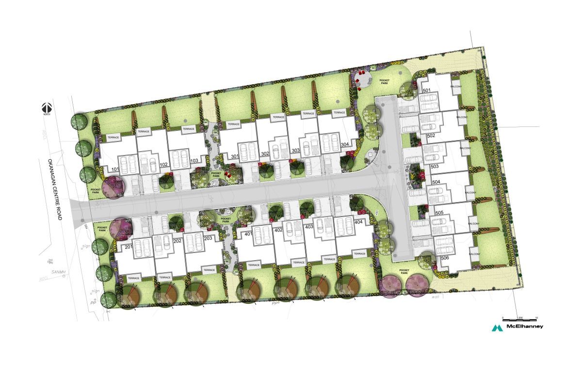
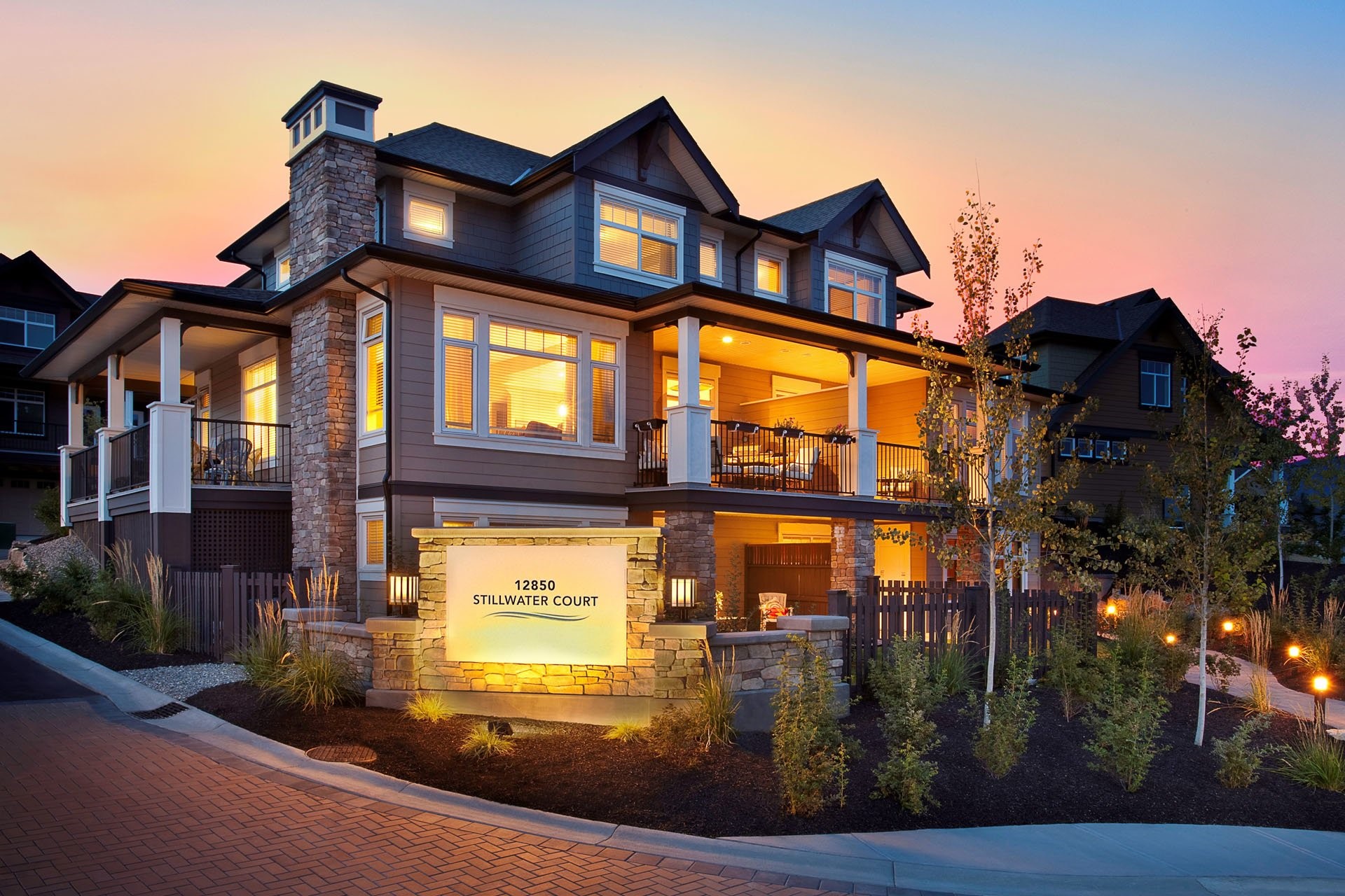
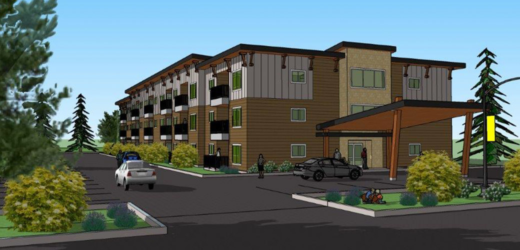
This multi-family housing would fill the gap between high-density townhomes and expensive single-family homes, but there was a time-sensitive challenge.
McElhanney’s familiarity with the Ministry of Forest’s approval requirements translated to a streamlined reporting process.
McElhanney contributed to the protection of at-risk ecosystems and species, while allowing a new housing development to move forward.
With a site including both a floodplain and a creek, the success of this development was contingent on the results of McElhanney’s engagement.
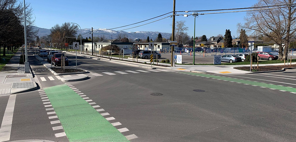
McElhanney provided detailed design and construction management for the 28th Avenue Street Improvements project.
McElhanney was retained by the City of Kelowna to provide civil engineering services for the Sutherland ‘2’ Active Transportation Corridor.
McElhanney acted as the Civil Engineering of Record for the 5th Phase of the City of Kelowna’s Ethel Street Active Transportation Corridor.
Our Penticton team provided engineering design, planning, construction & contract management, and inspection services for Meadows Subdivision.
Since 2010, McElhanney has provided Legal Surveying to Citimark for their Crystal Heights and Apex Townhouse development projects.
This 35-unit luxury townhouse development involved design of onsite and offsite roads, underground utilities, grading, storm drainage, cost estimating, and construction inspections and administration.
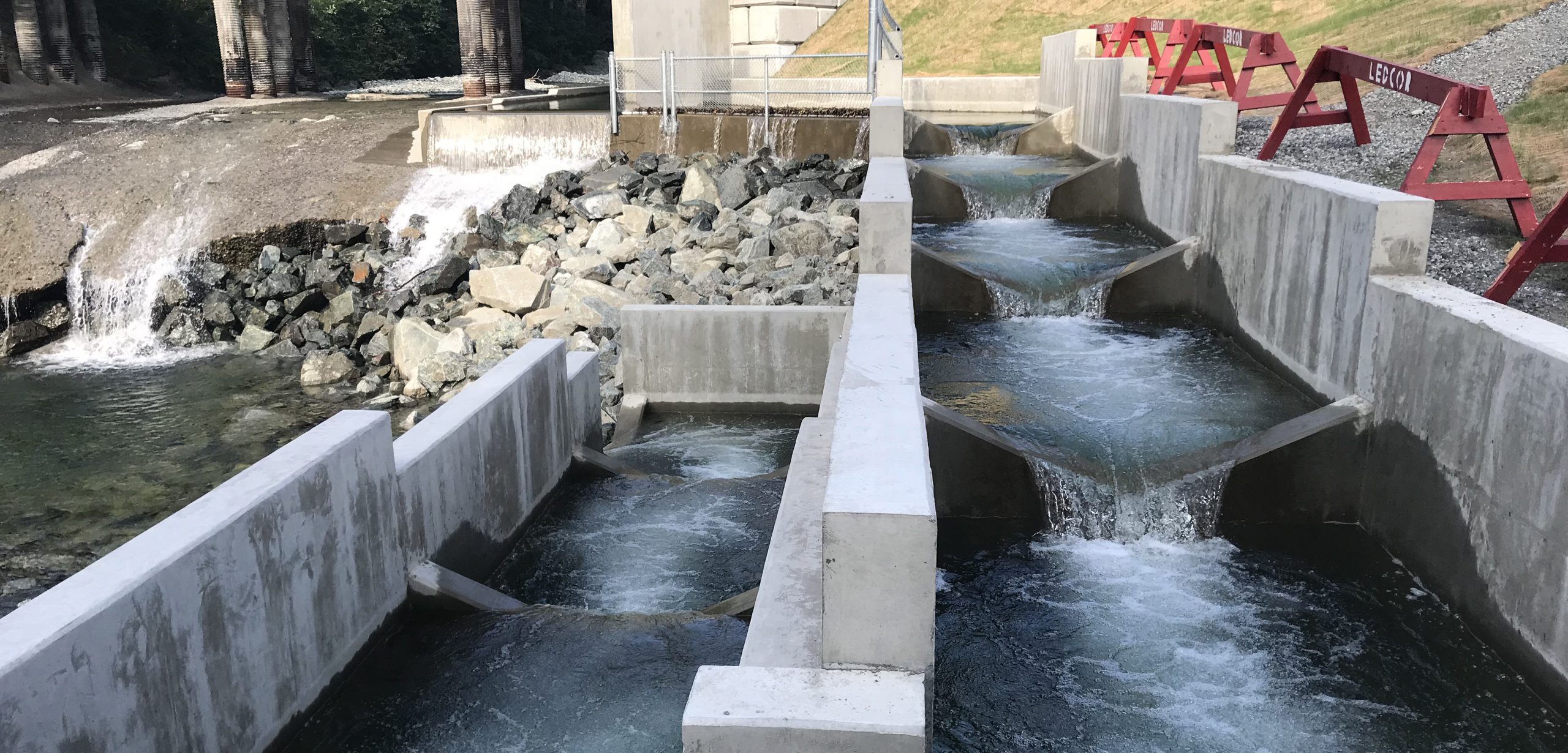
McElhanney was tasked with designing the Anderson Creek fishway to allow salmon to bypass a bridge apron that has deteriorated into a 3m concrete weir.
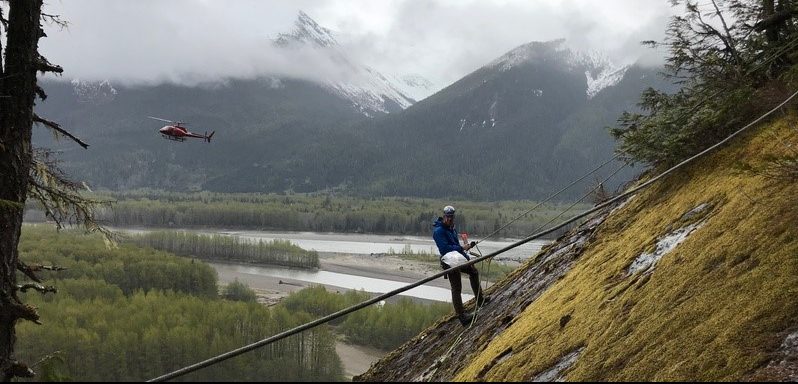
McElhanney’s structural engineers prepared a foundation design (including reinforced concrete and post-tensioned rock anchors) to assist with avalanche mitigation measures near Terrace, BC
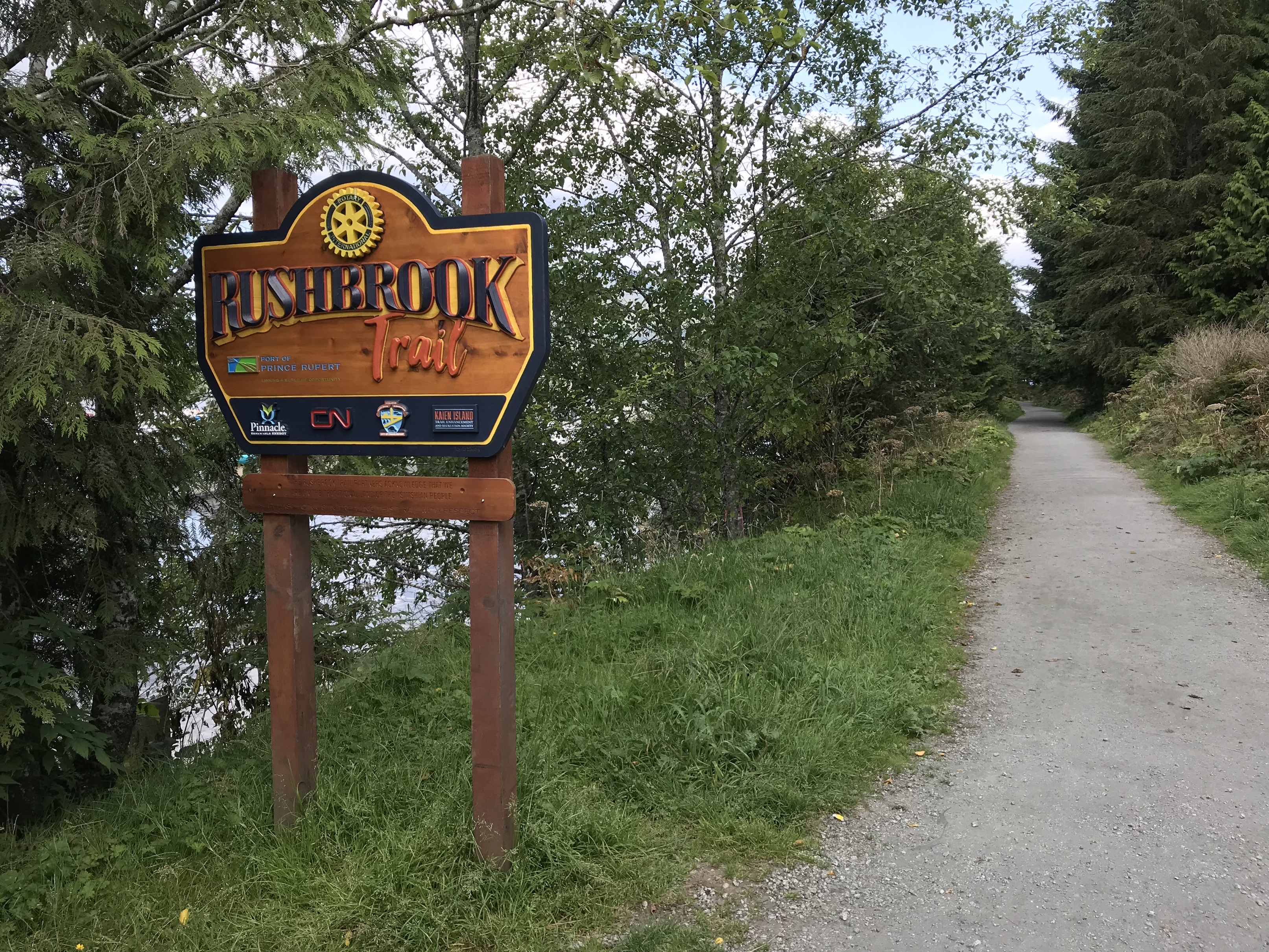
McElhanney assisted the Prince Rupert Rotary Club with the reconstruction of Rushbrook Trail in 2017.
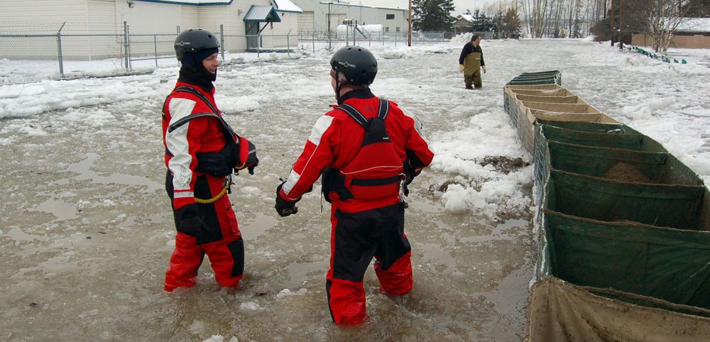
In December, 2007 the City of Prince George experienced a rapid cold snap which resulted in an ice jam on the Nechako River. A 66-day long local state of emergency was declared and over 100 residents were evacuated from their homes.
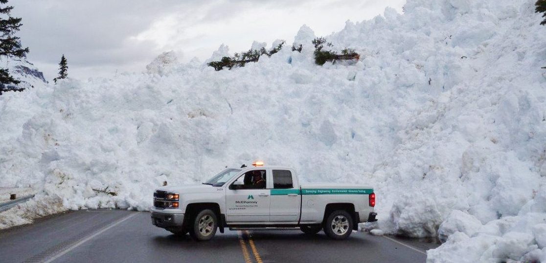
Since 2008, McElhanney has completed over 300 assignments for Parks Canada. This includes emergency response services for major floods in Banff, Jasper, and Kootenay National Parks in 2012 and 2013, as well as avalanche cleanup in Banff National Park in 2017.
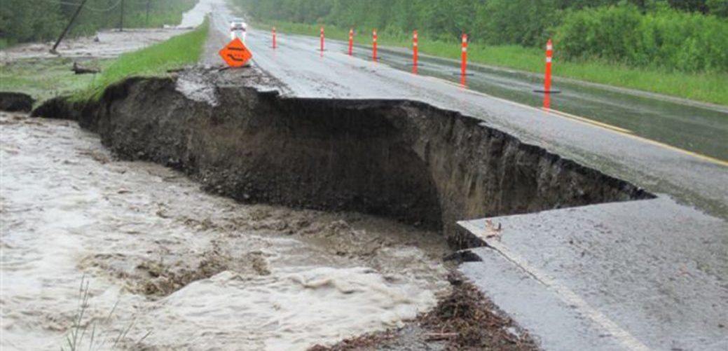
Following severe rain in June 2011, Hwy 97 experienced floods between Pine Pass and 20km south of Chetwynd (a length of 60km), with 73 damaged sites. This flooding resulted in the loss of culverts and bridge end fills, and washouts along various portions of the highway, forcing closure of this vital route.
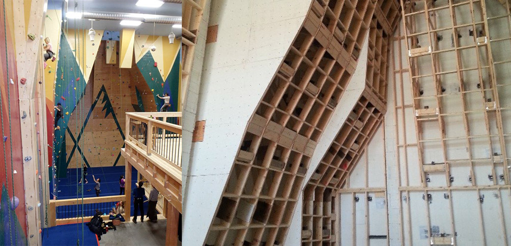
Kimberly, BC – The Spirit Rock Climbing Gym is located in Kimberly, BC. It features 6000 square feet of indoor and outdoor roped climbing, reaching heights of 50 feet and includes a 16 foot high top out bouldering area. In 2013, McElhanney provided geotechnical engineering and site reviews for the building foundation as well as structural engineering and inspection services for the climbing surfaces.
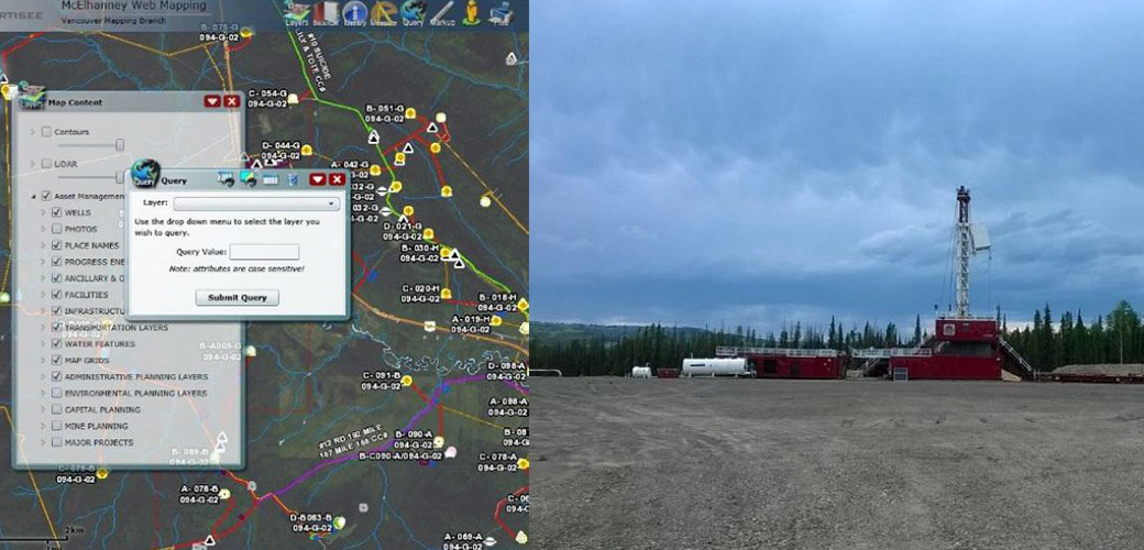
McElhanney was retained by Progress Energy for the purpose of asset management/inventory. McElhanney split the asset management project into 3 phases; (1) project initiation and development of Vertisee, an online web-based map to sort and file information collected on roads, bridges and other assets; (2) data acquisition and management; and (3) ongoing updates.
The Prince Rupert Gas Transmission Project (PRGTP) is a proposed 900 kilometre natural gas pipeline running from Hudson’s Hope to Lelu Island on the BCs North Coast. This project involved extensive digital data collection in the field using the latest technology and continual updates to Vertisee, McElhanney’s own web-based GIS mapping platform.
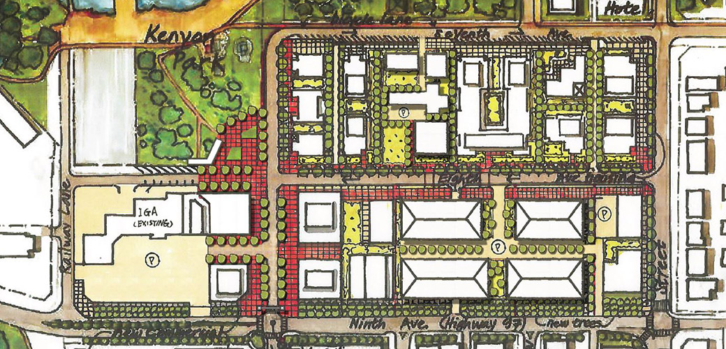
Design Scenarios for Okanagan Falls Town Centre 2016 | Okanagan Falls, BC – Okanagan Falls is located at the south end of Skaha Lake in BC. A private landowner and commercial real estate developer hired McElhanney to design alternative concepts for the community’s town centre.
FLNRO North Coast Land Use Planning 2012-2014 | Kitimat & Prince Rupert, BC – McElhanney provided GIS and mapping support for the land use development plan for future LNG and industrial developments in the Kitimat and Prince Rupert regions of Northern BC.
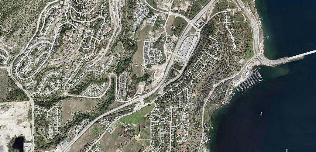
Highway 97 Corridor Improvements, Boucherie to Westlake Conceptual Planning Study 2013-2017 | West Kelowna, BC Highway 97 is the primary North-South roadway through the Okanagan Valley, connecting the communities of Osoyoos, Oliver, Penticton, Kelowna, Vernon, and Kamloops.
Haugland Housing 2016-2018 | Terrace, BC – This BC Housing project, located on Haugland Avenue near Hall Street, aimed to provide more affordable housing in the region, necessary because of the boom in Northern development with LNG projects and the Kitimat Modernization project.
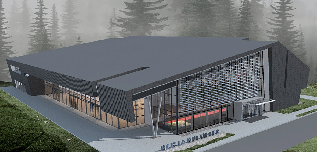
Haisla Multiplex – The Haisla Multiplex is a 40,000ft 2 High Importance category structure designed to serve several purposes. Not only is it a much-needed recreational space in the area, the building also converts into a shelter to act as post-disaster housing should a tsunami or other natural disaster occur.
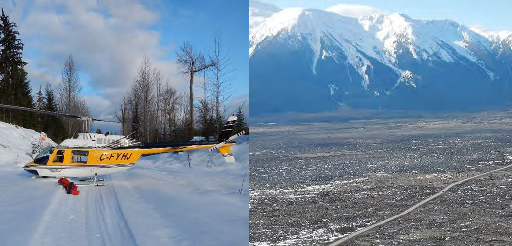
2009 | Remote Northern BC – The Government of BC hired McElhanney to head into the deep backcountry of the Skeena-Stikine and Kitimat regions. Our job was to identify critical bear habitat, along with important wintertime feeding areas for local moose populations and record our discoveries through mapping.
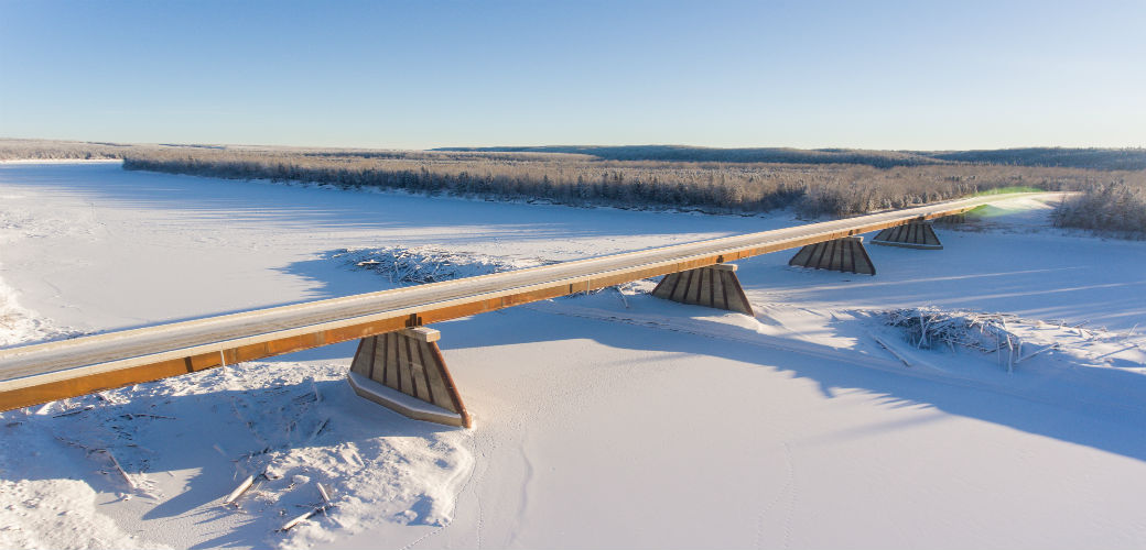
Fort Nelson, BC – Located approximately 70KM northwest of Fort Nelson on Highway 77, the Fort Nelson River Bridge provides access to the Liard Natural Gas basin and is the only road connection between BC and the Northwest Territories.


