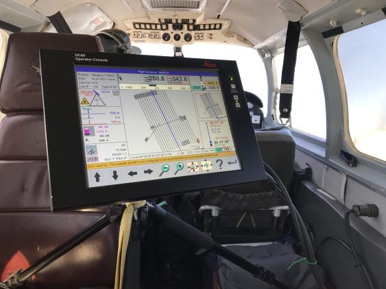
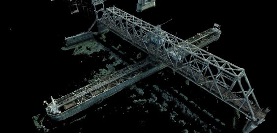
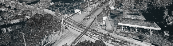
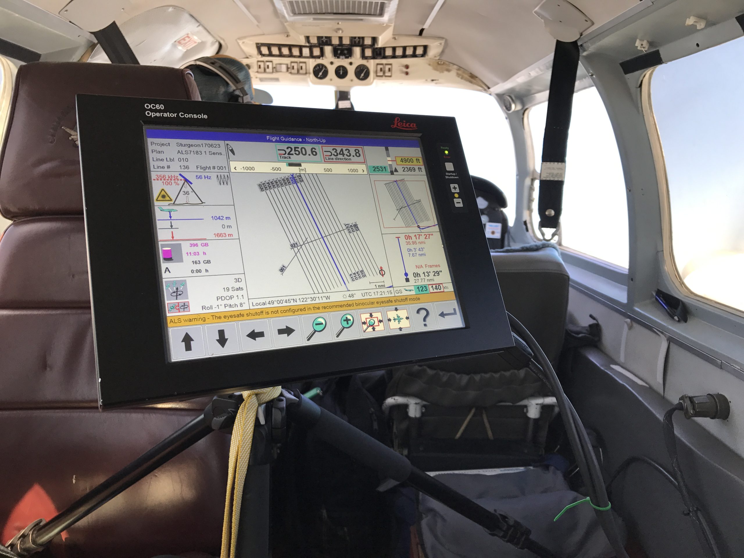
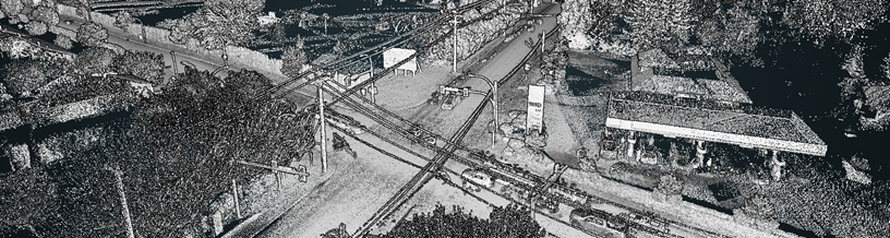
AI LiDAR, City of Vancouver
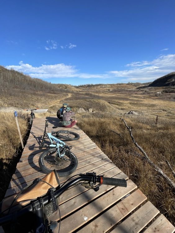
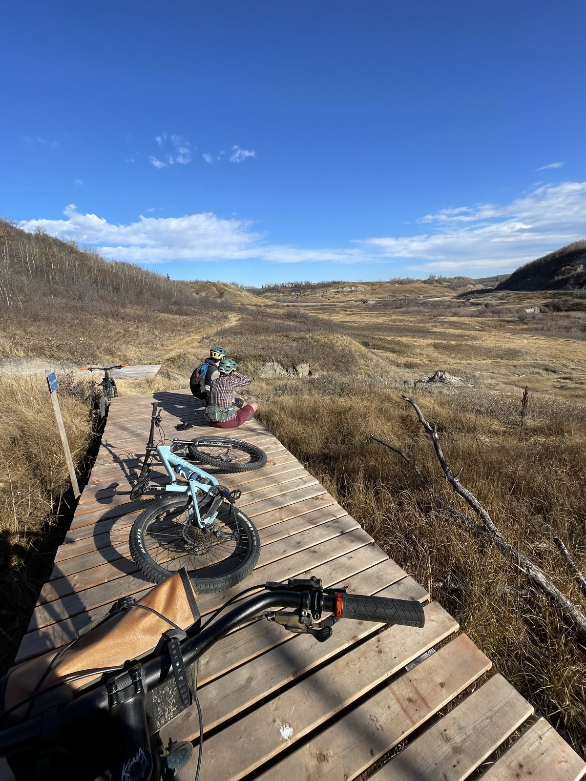
To support Stoney Creek Park trail system development, Camrose received grant funding to establish a Trail Master Plan for the Stoney Creek Valley.
3
To support Stoney Creek Park trail system development, Camrose received grant funding to establish a Trail Master Plan for the Stoney Creek Valley.
To support Stoney Creek Park trail system development, Camrose received grant funding to establish a Trail Master Plan for the Stoney Creek Valley.
To support Stoney Creek Park trail system development, Camrose received grant funding to establish a Trail Master Plan for the Stoney Creek Valley.
To support Stoney Creek Park trail system development, Camrose received grant funding to establish a Trail Master Plan for the Stoney Creek Valley.
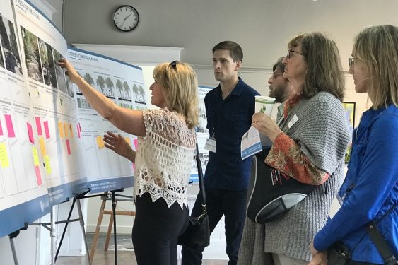
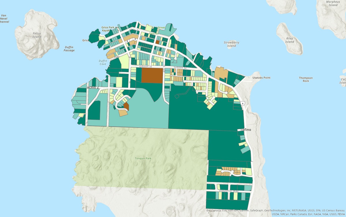
Tofino’s successful Housing Accelerator Fund application and subsequent planning support their objective to increase multi-family housing development.
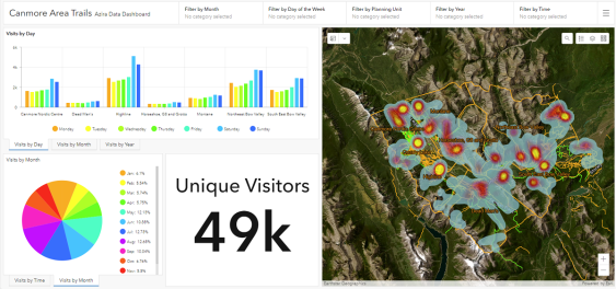
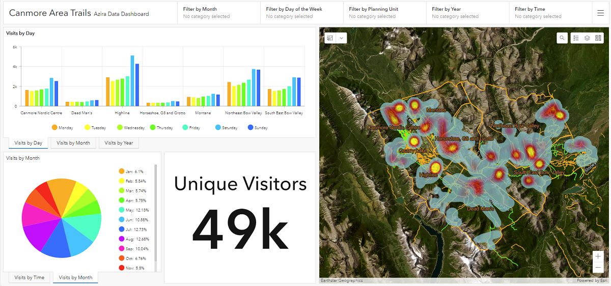
By leveraging big data to understand trail user trends, McElhanney teams are helping trail groups and clubs make sustainable long-term plans.
To support BC MoTI’s Resilient Highway Infrastructure Adaptation Program, we developed a system to identify, analyze, and map at-risk culverts province-wide.
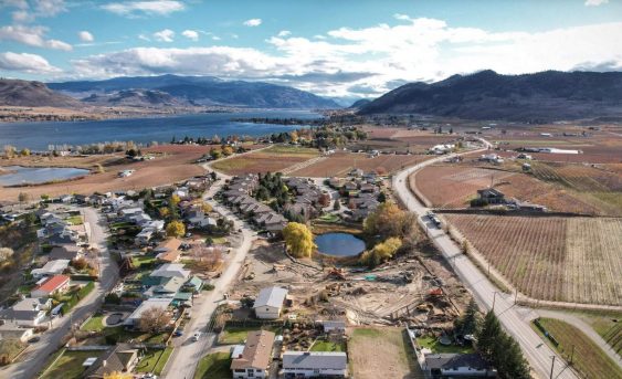
Lobelia Subdivision and Lobelia Drive Upgrades 202-22 | Osoyoos, BC The Lobelia Subdivision and Lobelia Drive Upgrades marked the conversion of a 3.24-acre family fruit farm, operational since the 1970s, into a thriving 15-lot single-family home community. In the spring of 2018, the Mackay family, who had recently inherited the family farm, faced the dilemma…
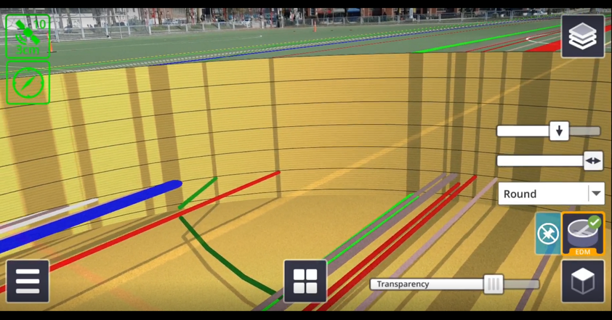
There are numerous applications for Trimble SiteVision, from underground utility exploration to aboveground boundary overlays.
McElhanney identified that a fly through visualization was a useful communication and engagement tool for the Memorial Hirst project.

