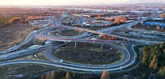
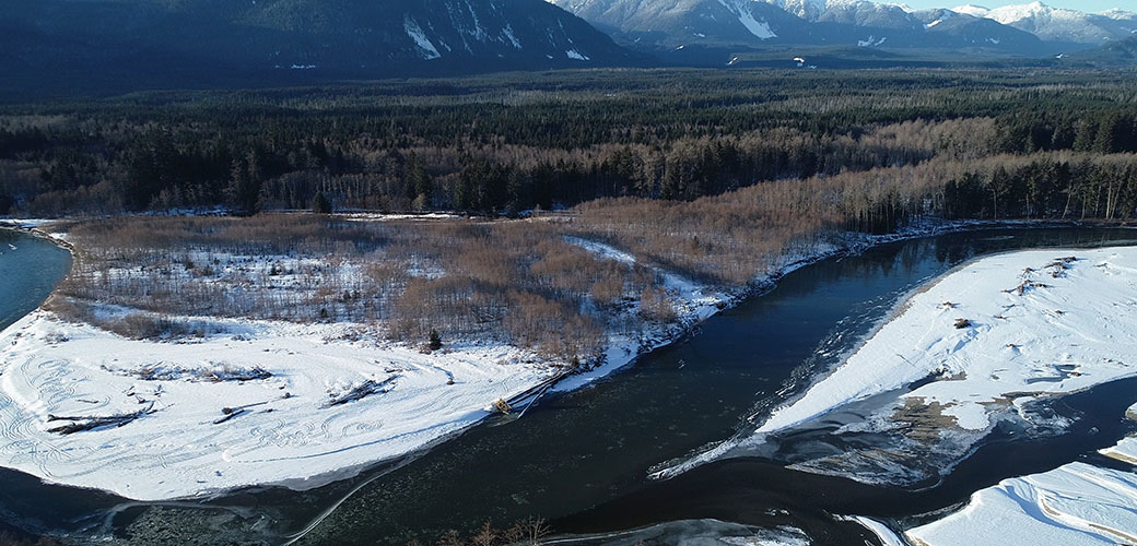
Skip to content
Search:

LOGIN

QUIZ

CONTACT

Linkedin page opens in new windowX page opens in new windowFacebook page opens in new windowInstagram page opens in new window
McElhanney
McElhanneyMcElhanney
    • Home
    • About
    • Services
      • Geomatics
      • Engineering
      • Geospatial
      • Planning
      • Landscape Architecture
      • Environmental
    • Portfolio
    • Careers
      • Career Opportunities
      • Culture
      • Career Growth
      • Students & New Graduates
    • News
    • Locations
    Linkedin Twitter Facebook Instagram
ZoomDetails

LakePointe Village Multi-Family Project

British Columbia, Cities & Communities, Community Development, Landscape Architecture, Northern, Interior, Central BC, Region, ServicesBy Andrea de VriesNovember 22, 2022

This multi-family housing would fill the gap between high-density townhomes and expensive single-family homes, but there was a time-sensitive challenge.

ZoomDetails

Inverness Culvert Watercourse Development Permit

British Columbia, Cities & Communities, Environmental, Environmental Assessment, Northern, Interior, Central BC, Region, ServicesBy Andrea de VriesNovember 21, 2022

McElhanney’s familiarity with the Ministry of Forest’s approval requirements translated to a streamlined reporting process.

ZoomDetails

Dinsmore Environmental Impact Assessment

British Columbia, Cities & Communities, Environmental, Environmental Assessment, Northern, Interior, Central BC, Region, ServicesBy Andrea de VriesNovember 21, 2022

McElhanney contributed to the protection of at-risk ecosystems and species, while allowing a new housing development to move forward.

ZoomDetails

Basecamp Apartments Riparian Area Protection Regulation (RAPR) Riparian Setback Assessment

British Columbia, Cities & Communities, Environmental, Environmental Assessment, Northern, Interior, Central BCBy Andrea de VriesNovember 21, 2022

With a site including both a floodplain and a creek, the success of this development was contingent on the results of McElhanney’s engagement.

Highway Engineering Services - Asset Management
ZoomDetails

Highway Engineering Services – Asset Management

British Columbia, Engineering, Geospatial, GIS & Spatial Analysis, Mapping, Parks, VertiseeBy Felicia KurnadiSeptember 8, 2021

McElhanney’s in house web mapping platform, Vertisee, was used to host all of the relevant project information including current and historical assets, orthophoto, LiDAR and field crew assessments.

Highway 1 – 264 to Whatcom Rd. Field Coordination
ZoomDetails

Highway 1 – 264 to Whatcom Rd. Field Coordination

British Columbia, Geospatial, GIS & Spatial Analysis, Lower Mainland, Mapping, VertiseeBy Felicia KurnadiSeptember 8, 2021

McElhanney deployed Vertisee, its own web-based mapping solution, and developed a tool within it which allowed multiple consultant / subcontractors to submit work simultaneously during the Highway 1 road upgrades.

Haisla Land Use Planning Featured Images
ZoomDetails

Haisla Land Use Planning

British Columbia, Geospatial, GIS & Spatial Analysis, Interest Holder Engagement & Communications, Land Use & Approvals, Mapping, VertiseeBy Felicia KurnadiSeptember 8, 2021

McElhanney’s GIS system, Vertisee, was used to identify potential land use conflicts and synergies, for a land use plan as part of the implementation of the First Nations Land Management Act for Haisla First Nation.

Metro Vancouver Regional Park
ZoomDetails

Metro Vancouver Regional Parks

3D Laser Scanning, British Columbia, Geospatial, GIS & Spatial Analysis, Lower Mainland, Mapping, Parks, Remote 3D Laser Scanning, VertiseeBy Felicia KurnadiSeptember 1, 2021

McElhanney designed and implemented a mobile field program and desktop conversion of various data sources to update Metro Vancouver Regional District’s spatial database of all assets owned and maintained by the Parks department.

28th Avenue Improvements
ZoomDetails

28th Avenue and 31st Street Improvements

British Columbia, Engineering, Northern, Interior, Central BC, Transportation, Transportation & TransitBy Jenn KuhnApril 19, 2021

McElhanney provided detailed design and construction management for the 28th Avenue Street Improvements project.

Sutherland Separated Bike Lane
ZoomDetails

Sutherland Ave. ATC ‘2’ Lake Ave. to Ethel Street

British Columbia, Engineering, Northern, Interior, Central BC, Transportation, Transportation & TransitBy Jenn KuhnApril 19, 2021

McElhanney was retained by the City of Kelowna to provide civil engineering services for the Sutherland ‘2’ Active Transportation Corridor.

←1
23
…45678…
91011
12→
©2021 McElhanney, All Rights Reserved | Sitemap Privacy Policy Terms & Conditions Login Contact |
LinkedinTwitterFacebook Instagram
Go to Top