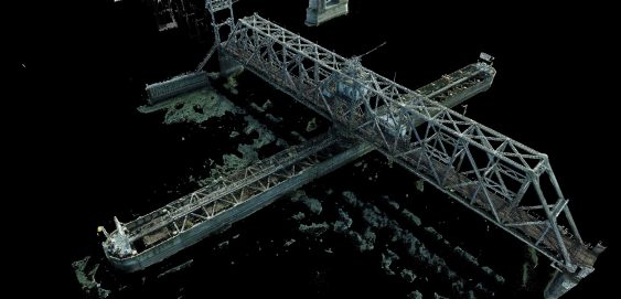
Fraser River Rail Bridge High-Definition Survey
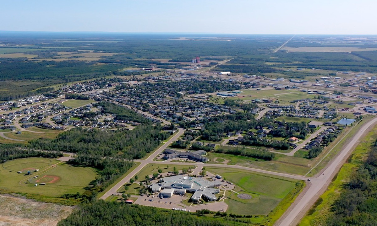
To support Stoney Creek Park trail system development, Camrose received grant funding to establish a Trail Master Plan for the Stoney Creek Valley.
11
To support Stoney Creek Park trail system development, Camrose received grant funding to establish a Trail Master Plan for the Stoney Creek Valley.
To support Stoney Creek Park trail system development, Camrose received grant funding to establish a Trail Master Plan for the Stoney Creek Valley.
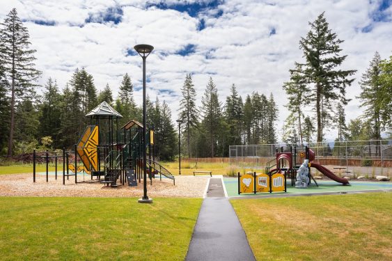
KFN members had no accessible, outdoor gathering space to meet, celebrate, gather, and play. Could a Canada Community Revitalization Fund grant meet their need?
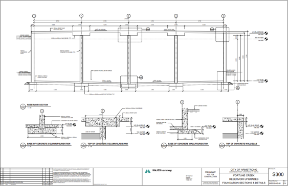
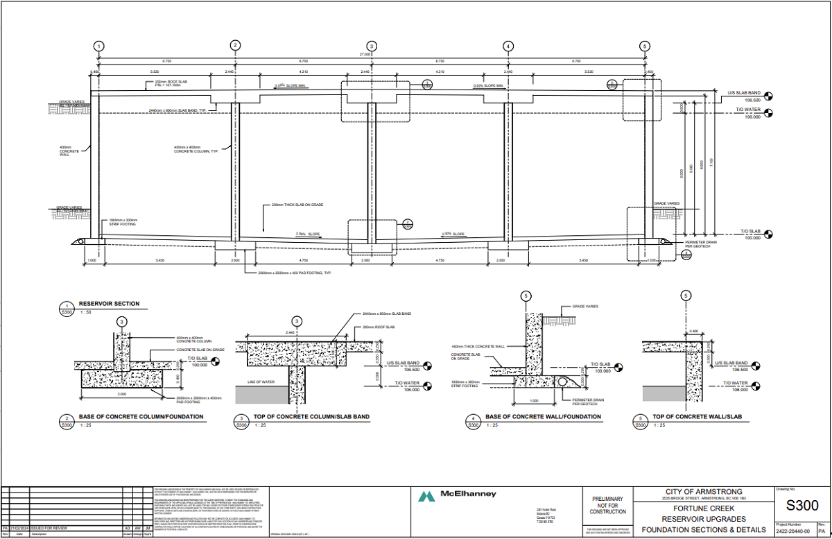
To address an existing water storage deficiency, the City of Armstrong requested a design for concrete potable water reservoirs.
McElhanney led a team of civil, process mechanical, structural, geotechnical, and electrical disciplines in the Wakefield lift station replacement.
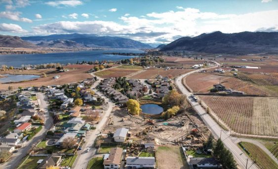
Lobelia Subdivision and Lobelia Drive Upgrades 202-22 | Osoyoos, BC The Lobelia Subdivision and Lobelia Drive Upgrades marked the conversion of a 3.24-acre family fruit farm, operational since the 1970s, into a thriving 15-lot single-family home community. In the spring of 2018, the Mackay family, who had recently inherited the family farm, faced the dilemma…
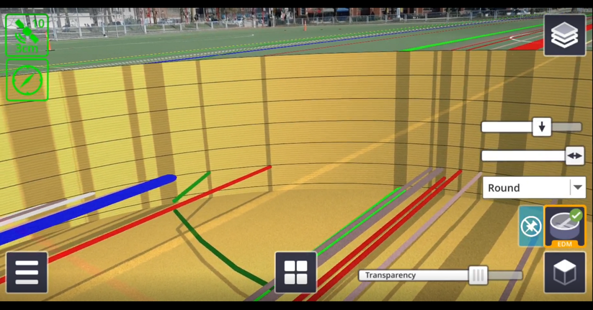
There are numerous applications for Trimble SiteVision, from underground utility exploration to aboveground boundary overlays.
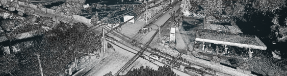
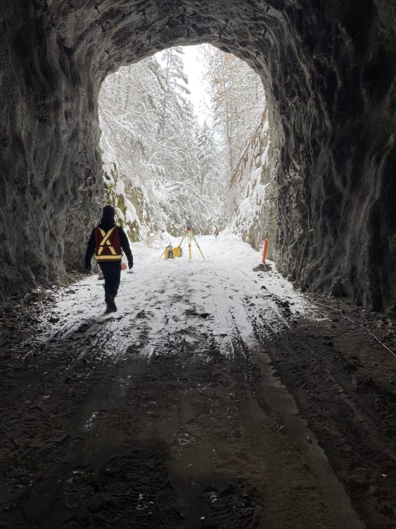
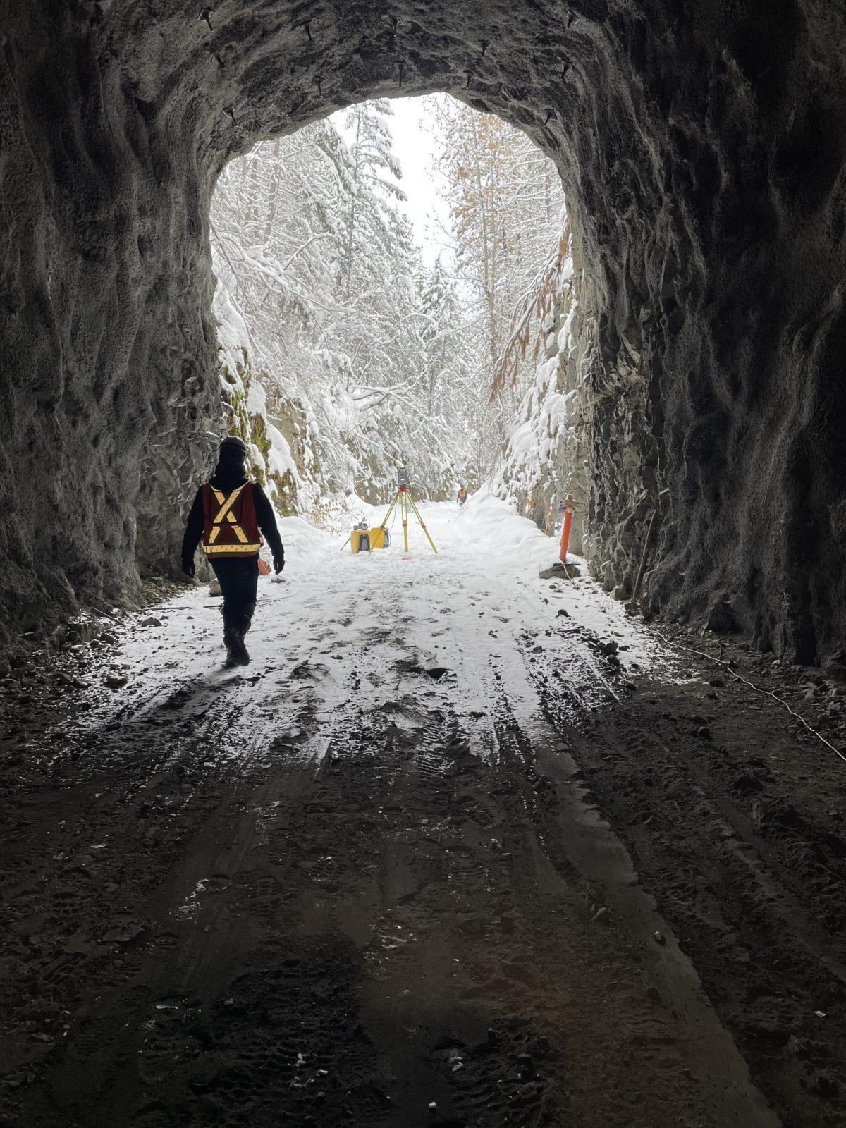
Adra Tunnel – Terrestrial LiDAR Scan 2022 | Penticton, BC The Adra Tunnel is part of the Kettle Valley Railway (KVR) corridor that links Myra Canyon above Kelowna to Penticton. The Railway was built over 100 years ago and is considered an Engineering marvel of its time. The Railway was decommissioned in the 1980s and is now…
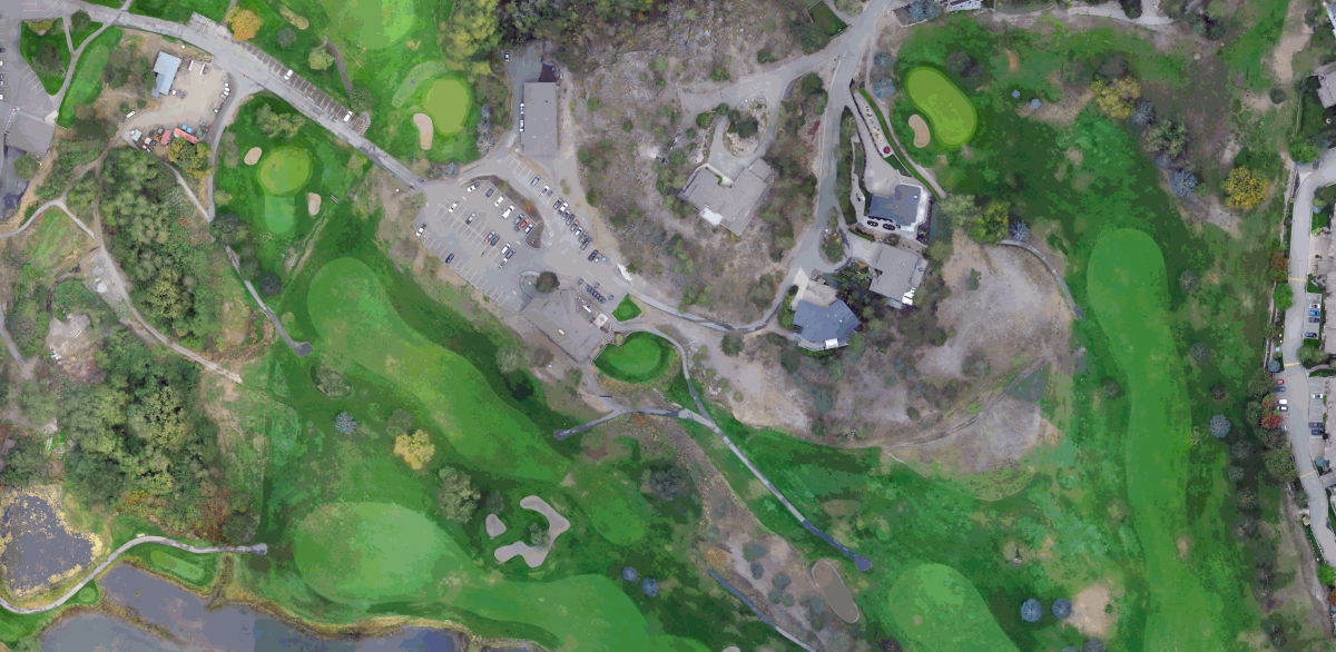
Shannon Lake Golf Course – Aerial Drone Survey 2022 | West Kelowna, BC The Shannon Lake Golf Course was undergoing an irrigation system upgrade and needed accurate topography of the entire 18-hole course for design purposes. A traditional ground survey could have been used, however a site of its size would have required multiple field…
The Town of Olds engaged McElhanney for infrastructure assessments including sanitary sewer and water main.


